This item has been sold, but you can get on the Waitlist to be notified if another example becomes available.
1973 Monroe County Advertising Map of the Florida Keys
FloridaKeys-monroecounty-1973-2$100.00


Title
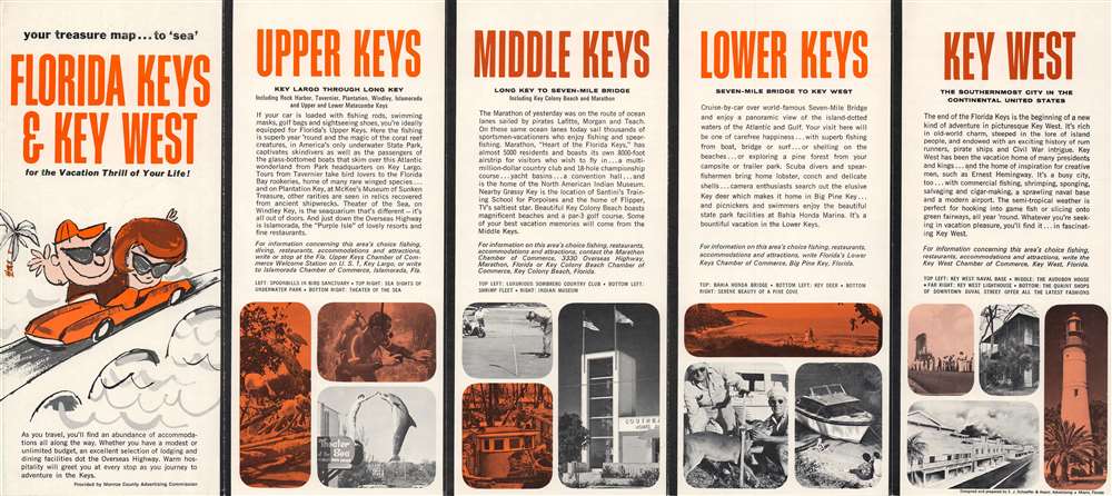
Your treasure map...to 'sea' Florida Keys and Key West for the vacation thrill of your life.
1973 (undated) 8.5 x 19 in (21.59 x 48.26 cm) 1 : 41000
1973 (undated) 8.5 x 19 in (21.59 x 48.26 cm) 1 : 41000
Description
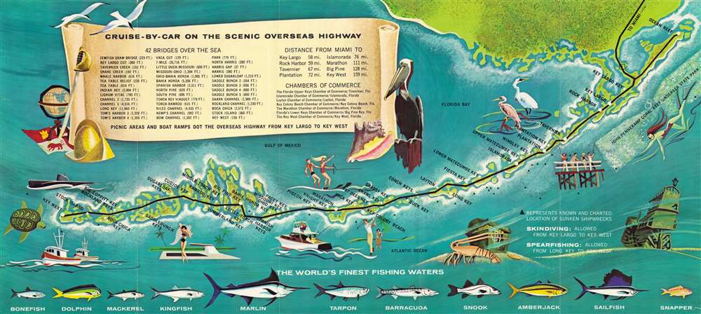
This is a c. 1973 Monroe County Advertising Commission map of the Florida Keys. The map marks stops along the Overseas Highway from Ocean Reef to Key West and identifies all major Keys. Illustrations of a heron, an egret, a pelican, and two terns underscore the birding opportunities of South Florida. Sportfish, including marlin and sailfish, adorn the bottom border and promote 'the world's finest fishing waters'. Vignettes of fishing boats, golfers, water-skiers, snorkelers, and shipwrecks highlight the many activities available to vacationers in the Keys. A scroll occupies most of Florida Bay and names forty-two of the bridges on the Overseas Highway and provides distances.
Publication History and Census
This map was created by E. J. Schaeffer and Associates and was published by the Monroe County Advertising Commission. It is well represented institutionally. Catalogued examples appear at the Library of Congress, Harvard University, the New York Public Library, and the University of Illinois at Urbana Champaign along with several others.Condition
Very good. Exhibits light wear along original fold lines. Text and printed images on verso.
References
OCLC 10298934.