
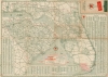
1948 Rand McNally 'Touring Map' of Florida and South Carolina

This item has been sold.
Texaco Touring Map of Florida South Carolina.
Drive and explore post-war Florida thanks to Texaco!
- Digital Map Information
- Suitable for large format printing
- File Size: 55.52 MB
- File Type: ZIP / TIFF
- ICC color profile embedded
- Delivered instantly via download link
Drive and explore post-war Florida thanks to Texaco!
This is a c. 1948 Rand McNally road map of Florida and South Carolina.A Closer Look
Florida and South Carolina are mapped with a focus on roads. Named road grades range from 'super highways' (4-lane pavement or over) to graded earth and unimproved roads. Red numbers indicate mileage between cities and towns; U.S. and state highways are identified by number. Small airplane icons mark airports. County and city, town, and village indexes are provided. Diagrams explain accepted traffic signals (left, right, and stop) and what diamond-shaped (danger) and octagon-shaped (full stop) signs always mean.Publication History and Census
This map was created and published by Rand McNally and distributed by Texaco c. 1948. We note cataloged examples bearing the same title from as early as 1944. We based the date for the present example on the table at the bottom near the center titled 'Gasoline Taxes - As of 2nd Sept. 1947.Cartographer
Rand, McNally and Co. (fl. 1856 - present) is an American publisher of maps, atlases and globes. The company was founded in 1856 when William H. Rand, a native of Quincy, Massachusetts, opened a print shop in Chicago. Rand hired the recent Irish immigrant Andrew McNally to assist in the shop giving him a wage of 9 USD per week. The duo landed several important contracts, including the Tribune's (later renamed the Chicago Tribune) printing operation. In 1872, Rand McNally produced its first map, a railroad guide, using a new cost effective printing technique known as wax process engraving. As Chicago developed as a railway hub, the Rand firm, now incorporated as Rand McNally, began producing a wide array of railroad maps and guides. Over time, the firm expanded into atlases, globes, educational material, and general literature. By embracing the wax engraving process, Rand McNally was able to dominate the map and atlas market, pushing more traditional American lithographic publishers like Colton, Johnson, and Mitchell out of business. Eventually Rand McNally opened an annex office in New York City headed by Caleb S. Hammond, whose name is today synonymous with maps and atlases, and who later started his own map company, C. S. Hammond & Co. Both firms remain in business. Further Details...
Condition
Average. Wear and toning along original fold lines. Areas of infill at fold intersections and along fold lines near the edges. Some soiling. Map of Georgia and Alabama on verso.