This item has been sold, but you can get on the Waitlist to be notified if another example becomes available, or purchase a digital scan.
1942 Manuscript Map of Guadalcanal, Solomon Islands
Guadalcanal-manuscript-1942$3,500.00


Title
Guadalcanal Island.
1942 (undated) 26.5 x 50.5 in (67.31 x 128.27 cm) 1 : 103000
1942 (undated) 26.5 x 50.5 in (67.31 x 128.27 cm) 1 : 103000
Description
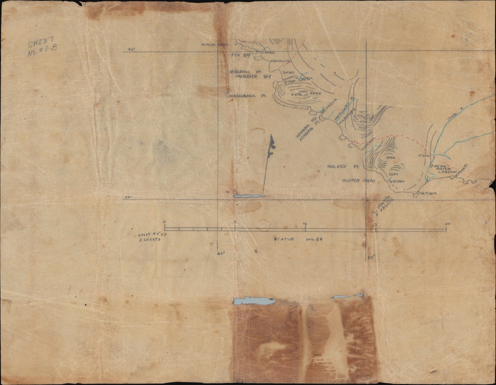
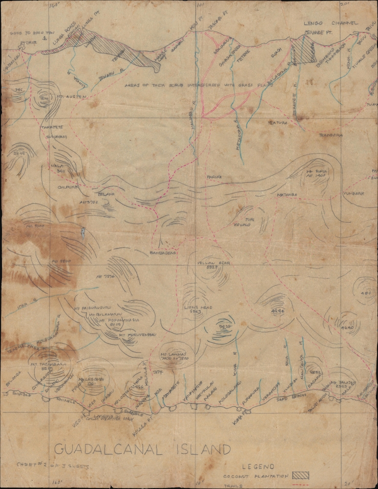
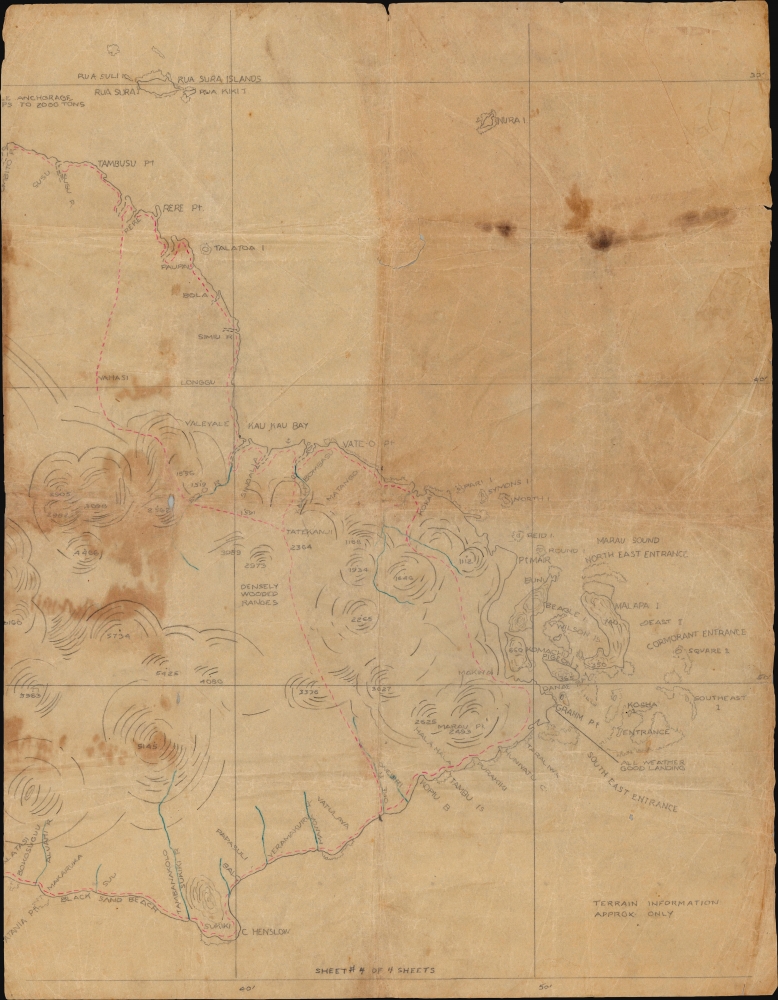
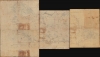
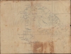
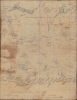
This is a 1942 four-sheet manuscript World War II map of Guadalcanal, Solomon Islands, prepared ship-board in anticipation of the decisive August 7, 1942, landing on Guadalcanal that began the Guadalcanal Campaign. It is one of the few surviving maps from the ad hoc Marine effort to gather critical reconnaissance on Guadalcanal days before the impending invasion. It is thus unique record of one of the most decisive and pivotal battles in the World War II (1939 - 1945) Pacific Theater.
Coverage embraces the full island of Guadalcanal. Red dashed lines follow trails with extensive coconut plantations defined by diagonal lines. Rivers and mountains are illustrated, with some elevations noted. The terrain is described, including 'grassy slopes,' 'densely wooded,' and 'areas of thick scrub interspersed with grass plains.' Coastal points, bays, beaches, and other features important to the invasion force are identified. Offshore anchorages are noted, including two that are 'good up to 2,000 tons'.
The Solomon Islands were only tenuously mapped prior to 1942. Pre-invasion mapping was assigned to division intelligence officer, Lieutenant Colonel Frank B. Goettge (1895 - 1842). He compiled a series of new maps based on existing nautical charts enhanced with interview reconnaissance from ship-masters, planters, traders, aerial photography, and ship-side observation. Unfortunately, none of these maps made it to Guadalcanal. Logistical disorganization in New Zealand led to the Goettge maps being misplaced and never loaded onto the supply ships. Goettge himself was killed in the early days of the invasion on the ill-fated 'Goettge Patrol'.
Without access to Goettge's printed maps, he and the other invading Marines compiled their own ad hoc maps based upon memory, ship-side coastal observations, and aerial photography - this latter limited by weather conditions and enemy activity. Reportedly, even on the most successful mission, the aircraft was harassed by Japanese Zeros such that no photographs of the critical airfield could be taken. Such conditions explain the airstrip's conspicuous absence on this very map. In fact
In May 1942, the Japanese occupied Guadalcanal in the Solomon Islands, where, using Korean forced labor, they began constructing an airbase. Recognizing a serious threat to shipping, the Allies accelerated plans to retake the island. The invasion initially proceeded smoothly, with Marines seizing the offending airfield, which they renamed Henderson Field. Japanese forces retreated into the surrounding jungles and mountains. Meanwhile, retaliatory air strikes forced Allied supply ships to retreat, leaving the Marines at Henderson Field stranded with limited supplies. From their mountain and jungle hideouts, Japanese forces began a guerilla war to retake the island.
From mid-August 1942 through January 1943, land, sea, and air battles raged, as both sides committed to controlling Guadalcanal. Tenacious Japanese attacks failed to dislodge the entrenched Americans while depleting Japanese forces faster than they could be reinforced. By late October, the Marines began doggedly expanding their perimeter into the surrounding jungles. By the end of December, the Japanese began a full retreat.
In the end, both sides suffered staggering losses, the Allies mostly at sea and the Japanese mostly on land. However, Allied losses were easily replaced while Japan lacked the population and industrial capacity to replenish its own forces. By committing so heavily to Guadalcanal, the Japanese diverted resources from other campaigns, allowing the Allies to take the initiative. Following Guadalcanal, the Pacific War shifted in the favor of the Allies.
A Closer Look
The map is unsigned and undated, but much can be inferred from the format, style, and content. It is in pencil on thin but resilient parchment-like paper. That this map is in manuscript, combined with the lack of the airfield (after the invasion, the center of American activity on Guadalcanal) make it clear that it was made on-the-spot in anticipation of the invasion. It was likely produced through a combination of limited ship-board triangulation of observable peaks (hence the sporadic elevation data) and interpretation of aerial photographs.Coverage embraces the full island of Guadalcanal. Red dashed lines follow trails with extensive coconut plantations defined by diagonal lines. Rivers and mountains are illustrated, with some elevations noted. The terrain is described, including 'grassy slopes,' 'densely wooded,' and 'areas of thick scrub interspersed with grass plains.' Coastal points, bays, beaches, and other features important to the invasion force are identified. Offshore anchorages are noted, including two that are 'good up to 2,000 tons'.
The Marines and the Mapping of Guadalcanal
Allied plans to retake Guadalcanal were accelerated due to the forced-labor construction of a Japanese airstrip there. The first 'warning-order' for the retaking of Guadalcanal was issued on June 26, 1942, less than a month before the scheduled invasion. A frenzied effort followed to prepare and equip the Marines so tasked.The Solomon Islands were only tenuously mapped prior to 1942. Pre-invasion mapping was assigned to division intelligence officer, Lieutenant Colonel Frank B. Goettge (1895 - 1842). He compiled a series of new maps based on existing nautical charts enhanced with interview reconnaissance from ship-masters, planters, traders, aerial photography, and ship-side observation. Unfortunately, none of these maps made it to Guadalcanal. Logistical disorganization in New Zealand led to the Goettge maps being misplaced and never loaded onto the supply ships. Goettge himself was killed in the early days of the invasion on the ill-fated 'Goettge Patrol'.
Without access to Goettge's printed maps, he and the other invading Marines compiled their own ad hoc maps based upon memory, ship-side coastal observations, and aerial photography - this latter limited by weather conditions and enemy activity. Reportedly, even on the most successful mission, the aircraft was harassed by Japanese Zeros such that no photographs of the critical airfield could be taken. Such conditions explain the airstrip's conspicuous absence on this very map. In fact
The coastal map of Guadalcanal finally adopted as official by the 1st Marine Division (and employed, with such corrections as could later be developed, throughout the entire campaign) was traced from an aerial strip-map obtained by Colonel Goettge on his mission to Australia, and, while reasonably accurate as to the general outline, contained no usable indications of ground-forms or elevations. (Zimmerman, J. L., The Guadalcanal Campaign, page 17.)
The Guadalcanal Campaign
The months-long battle for Guadalcanal took place at a critical moment in the Pacific War. The Allies had inflicted heavy losses on the Japanese at Midway, but the overall situation remained uncertain. The Japanese advance through Southeast Asia continued while their aggressive progress in the Pacific threatened Allied communication and supply lines.In May 1942, the Japanese occupied Guadalcanal in the Solomon Islands, where, using Korean forced labor, they began constructing an airbase. Recognizing a serious threat to shipping, the Allies accelerated plans to retake the island. The invasion initially proceeded smoothly, with Marines seizing the offending airfield, which they renamed Henderson Field. Japanese forces retreated into the surrounding jungles and mountains. Meanwhile, retaliatory air strikes forced Allied supply ships to retreat, leaving the Marines at Henderson Field stranded with limited supplies. From their mountain and jungle hideouts, Japanese forces began a guerilla war to retake the island.
From mid-August 1942 through January 1943, land, sea, and air battles raged, as both sides committed to controlling Guadalcanal. Tenacious Japanese attacks failed to dislodge the entrenched Americans while depleting Japanese forces faster than they could be reinforced. By late October, the Marines began doggedly expanding their perimeter into the surrounding jungles. By the end of December, the Japanese began a full retreat.
In the end, both sides suffered staggering losses, the Allies mostly at sea and the Japanese mostly on land. However, Allied losses were easily replaced while Japan lacked the population and industrial capacity to replenish its own forces. By committing so heavily to Guadalcanal, the Japanese diverted resources from other campaigns, allowing the Allies to take the initiative. Following Guadalcanal, the Pacific War shifted in the favor of the Allies.
Publication History and Census
This map was drawn by an unknown hand between June and August 1942. As it is a manuscript map, it is one-of-a-kind. There are a few manuscript maps of a similar style, likely part of the same pre-invasion effort, preserved at the Library of Congress. There is no record of this or any similar maps on the private market.Condition
Average. Manuscript pencil on four (4) sheets of parchment-like paper. Tears and fold separations. Soiling.
References
Zimmerman, J.L., The Guadalcanal Campaign (Historical Division, U.S. Marine Corps) 1949.