1712 Wells Map of France
France-wells-1712$225.00

Title
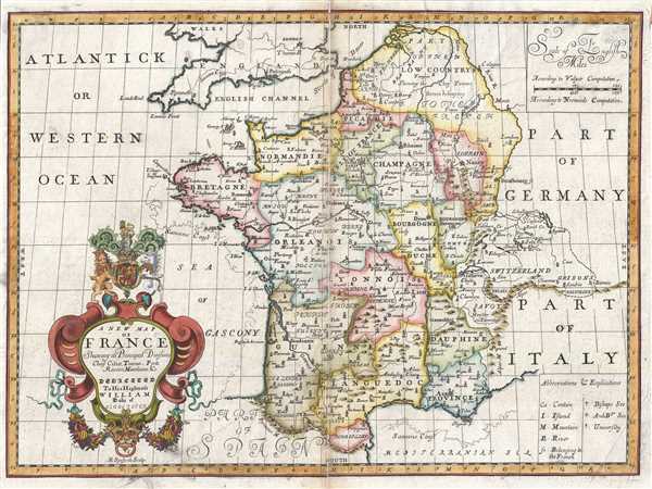
A New Map of France Shewing its Principal Divisions Chief Cities, Townes, Ports Rivers, Mountains, etc.
1712 (undated) 15 x 20 in (38.1 x 50.8 cm) 1 : 3468960
1712 (undated) 15 x 20 in (38.1 x 50.8 cm) 1 : 3468960
Description
This is a lovely 1712 map of France by Edward Wells of Oxford. It covers all of France and parts of Belgium and Switzerland. Notes the principal divisions, cities, towns, rivers, roads and other topographical features.
At the opening of the 18th century France was one of the dominant powers in Europe. With a population of nearly 19,000,000 people under a single government and ample arable farmland, France dominated most of Europe socially and economically.
A decorative cartouche appears on the bottom left quadrant of the map featuring the coat of arms of the Duke of Gloucester. This, like many other Wells maps, is dedicated to Prince William, Duke of Gloucester and son of Queen Anne, who, when this map was being prepared, was a student at Oxford. Engraved by R. Spofforth and published by T. Bonwicke for the 1712 edition of Edward Wells' Atlas, A New Sett of Maps both of Ancient and Present Geography.
Cartographer
Edward Wells (1667 - 1727) was an English mathematician, geographer, and classical scholar based at Christ Church College, Oxford. Wells trained for the ministry but quickly found himself unsuited to religious life and instead applied for an academic position at Oxford, where he authored numerous well respected works on a wide range of mathematical and scientific topics. He tutored Prince William, the sickly son of Queen Anne, who was likely about 11 at the time this map was prepared. Wells dedicated nearly all of the maps in his atlas, A New Sett of Maps both of Ancient and Present Geography, to the young prince - quite possibly posthumously, as William died in July of 1700 shortly prior to the publication of the atlas. Nonetheless, Wells' geography proved popular and was published in number editions well into the 1730s. More by this mapmaker...
Source
Wells, E., A New Sett of Maps both of Ancient and Present Geography, (London, T. w. Bonwicke) c. 1712.
A New Sett of Maps both of Ancient and Present Geography was published by Edward Wells in various editions between 1701 and 1730. The publication contained some 40 maps all of which were dedicated to Prince William, Duke of Gloucester. Wells tutored the young prince at Christchurch, Oxford and seems to have developed a close relationship with him. At just 11 years of age, William died in 1700 and never had the opportunity to see the published work that he inspired. The atlas was intended for educational purposes with a focus on school use.
Condition
Very good. Some wear and toning along original centerfold. Damage to centerfold, repaired. Original platemark visible. Professionally flattened and backed with archival tissue. Minor creasing and foxing.
References
Rumsey 11181.011.