1956 Mejorada Geological Map of Western Mexico (Sonora)
GeologicalMexico-mejorada-1956$100.00

Title
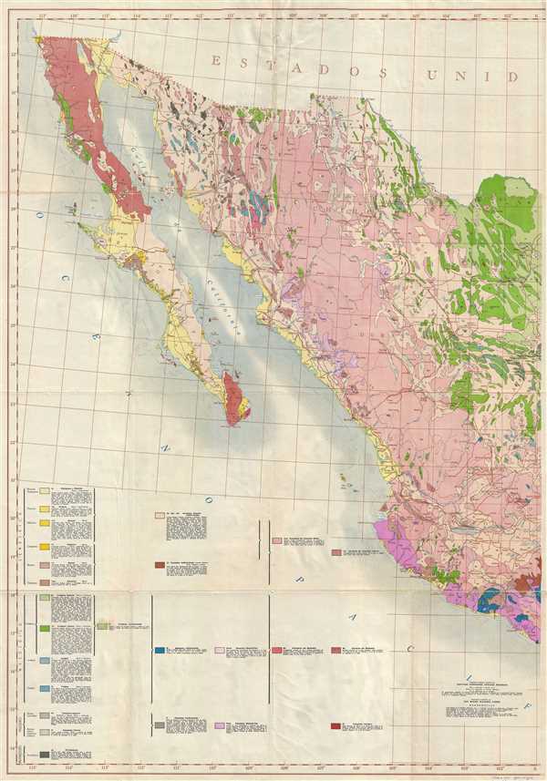
Carta Geologica de la Republica Mexicana.
1956 (dated) 45 x 31.5 in (114.3 x 80.01 cm) 1 : 2000000
1956 (dated) 45 x 31.5 in (114.3 x 80.01 cm) 1 : 2000000
Description
This is a 1956 Santiago Hernandez Sanchez Mejorada geological map of western Mexico including most of Sonora. The map depicts Mexico from the Pacific Ocean to Zacatecas and Coahuila and from the U.S.-Mexico border to Jalisco and Michoacán. Twenty-five different geological formations are identified in the key in the lower left corner, ranging from Pre-Cambrian to Pleistocene. The colors are vibrant and are easily identified, particularly the shade of red on Baja California and the blues which are scattered throughout the map. This eye-catching piece apperas to be the western part of a larger 2 sheet set.
This map was compiled by Santiago Hernandez Sanchez Mejorada in 1956.
This map was compiled by Santiago Hernandez Sanchez Mejorada in 1956.
Condition
Very good. Wear along original fold lines. Verso repairs at fold intersections. Blank on verso.
References
OCLC 429712196.