
1876 Bachelder Map of the Battle of Gettysburg

This item has been sold.
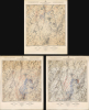
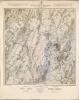
Map of the Battle Field of Gettysburg. July 1st, 2nd, 3rd 1863. First Day's Battle / Second Day's Battle / Third Day's Battle.
Turning Point of the Civil War.
- Digital Map Information
- Suitable for large format printing
- Full resolution TIFF file
- ICC color profile embedded
- Delivered instantly via download link
Turning Point of the Civil War.
This is John Badger Bachelder's foundational 1876 set of three large-format maps of the Battle of Gettysburg, the definitive turning point of the American Civil War (1861 - 1865). Bachelder had dedicated much of the 13 years since the battle had taken place to researching it, making him the foremost authority on it, resulting in these maps being the definitive contemporaneous account.A Closer Look
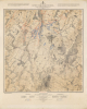
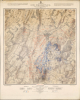
These three mammoth sheets represent Bachelder's synthesis of the Battle of Gettysburg as it progressed over 3 days. They are notably different from his other works relating to Gettysburg, being more forensic than visually dramatic (for comparison, see our earlier listings of his work, such as Gettysburg-bachelder-1863 and BattleofGettysburg-bachelder-1905). The maps represent the most advanced topographical maps of the era, with minute detail on terrain, elevation (represented by contour lines), foliage, waterways, structures, roads, and more. As explained at the top-right, notation is even used to distinguish between the materials of different buildings (stone, brick, wood) and different types of fences between properties. Every structure in and around Gettysburg is represented.Most prominently, red and blue lines represent units of the Confederate and Union armies, with notation, explained at bottom, indicating their positions at various times of the day, demonstrating the evolution of the battle. Commanding officers of both armies are listed at the bottom, while symbols (badges) indicate the divisions and corps of Union units.
The Battle of Gettysburg - Day by Day
The Battle of Gettysburg (July 1 - 3, 1863) was the definitive encounter of the U.S. Civil War. Before it, the Union was flailing despite its considerable economic and demographic advantages, beset by infighting, incompetent generals, and muted enthusiasm for the war. Afterward, Union victory was only a matter of time, especially as the victory at Gettysburg coincided with another significant victory in the Western Theater at Vicksburg.The battle resulted from Gen. Robert E. Lee's attempt to invade the North and convince the Union to agree to a peace that left the Confederacy independent. After winning the Battle of Chancellorsville in early May, Lee tried to draw the bulk of Federal forces into a battle on his terms and for weeks the two armies (Lee's Army of Northern Virginia and the Army of the Potomac, led by Joseph Hooker and then George Meade) shadowed each other, fighting minor engagements. One of these chance encounters, on July 1 just outside the town of Gettysburg, Pennsylvania, expanded and eventually drew in both armies so that both sides had tens of thousands of troops engaged by the end of the first day's fighting.
As seen here, most of the fighting on the first day took place north and west of the town, with two Confederate attacks being repulsed before a third broke through, as Union troops retreated to the high ground of Cemetery Hill southeast of the town. As the Confederates had suffered high casualties, the Confederate commander on site (Lee was still in transit), Gen. Richard Ewell, decided not to pursue the attack further.
On July 2, Lee sought to break the Union line by attacking both flanks. General James Longstreet led Confederate assaults on the Union left at Little Round Top, the Wheatfield, and the Peach Orchard, while Ewell's forces attacked the right flank at Culp's Hill. Despite fierce fighting and heavy casualties on both sides, Union troops managed to hold most of their positions. The Union line, resembling a fishhook anchored on Cemetery Hill, remained intact by nightfall, though both armies had suffered thousands of casualties.
On July 3, Lee launched one final, massive assault aimed at the Union center on Cemetery Ridge. After a thunderous Confederate artillery barrage, some 12,000 men under General George Pickett and others advanced across open fields in what became known as Pickett's Charge. The attack was repulsed with devastating losses, shattering Confederate hopes for victory in the North. That night and the following day, Lee withdrew his battered army back toward Virginia. Meade was criticized at the time and since for not aggressively pursuing the Confederates, but he believed his exhausted army would have difficulty doing so and might fall into a trap (for which, in fact, Lee was hoping and preparing). Nevertheless, Meade was seen as overly-cautious and in March 1864, the more aggressive Ulysses S. Grant, the victor at Vicksburg, was given command of all Union armies.
Bachelder and Gettysburg
John Badger Bachelder was determined to chronicle the most important battle of the American Civil War, hoping to capture an historic moment like Emanuel Leutze's Washington Crossing the Delaware. He arrived on the front lines in 1862 and began meticulously detailing battles, not knowing which would be the defining engagement. When news of fighting at Gettysburg arrived, he rushed to the battlefield, reaching it one day after the battle ended. In the words of Confederate General Wade Hampton of South Carolina,…he reached the battlefield of Gettysburg before the dead were buried, remaining for eighty-four days, making plans of the field, visiting the wounded in hospital, and by permission taking the convalescent officers over the field, by whom their positions and movements were pointed out and established.He subsequently issued a detailed report of the battle, the three maps seen here, and two dramatic views of the battlefield, one a general overview and the other based on a grand, 20-foot-wide mural that he had commissioned the artist James Walker to paint, illustrating Longstreet's disastrous charge (Pickett's Charge). Based upon his meticulous research, Bachelder was able to reconstruct the battle in full, rendering a tremendous service to both his contemporaries and posterity.
Publication History and Census
These maps were prepared by Bachelder, based on years of research, and printed by Endicott and Co. in 1876, with topography by Julius Bien and lettering by Louis E. Neuman. As Bachelder explains in a note at top-left of each sheet, these maps are based on even larger originals (1 : 2400) produced by the U.S. Army Corps of Engineers. Because of the maps' long titles, with different 'subtitles' (First / Second/ Third Day's Battle) for the three maps, cataloging is not consistent, with some institutions cataloging all three maps together under the main title, others cataloging them individually with the main title and subtitle, and some only cataloging the subtitle. The maps are well-represented institutionally, but only occasionally come to market, especially as full three-map set.Cartographers
John Badger Bachelder (September 29, 1825 – December 22, 1894), also spelled Batchelder, was an American portraitist, landscape artist, lithographer, cartographer, and photographer. In his life he was best known as the preeminent expert on the 1863 Battle of Gettysburg, of which he produced the most iconic representation. Bachelder was born in Gilmantown, New Hampshire and was educated at Captain Alden Partridge's Military School in Pembroke. Upon graduating he relocated to Reading, Pennsylvania, where he took a position at the Pennsylvania Military Institute. He became the head of that institution in 1851. In 1852 he was appointed colonel of the Pennsylvania State Militia. Around 1853 Bachelder returned to New Hampshire to pursue a career as an artist, publishing various views of New England towns; 1854 found him living and working in Manchester, and perhaps this is what led him to produce four views of the city - more than any other place he depicted in print. Bachelder's military training influenced his art materially and he developed a lifelong interest in depicting the dynamics of great battles on canvas. When the American Civil War broke out in 1861, Bachelder was working on a view of the Revolutionary War battle of Bunker Hill. From his work on the Bunker Hill view, Bachelder noted how difficult it was to reconstruct a battle long after the events when most major participants had passed on. He saw an opportunity in the outbreak of the Civil War and attached himself to the Union Army of the Potomac in the hopes of being present at a major battle. He was welcomed on the battlefield, where his accurate drawings helped the generals to better understand the conflicts in question. His most significant work his an impressive bird's-eye view of the Battle of Gettysburg. Though not present at the battle, he was there day's after, and claims to have interviewed the commanders of every regiment and battery in the Army of the Potomac, as well as thousands of wounded soldiers on both sides of the conflict. His work was so precise and significant he was commended to President Lincoln and later took a position as Superintendent of Tablets and Legends for the Gettysburg Battlefield Memorial Association. He is responsible for the monuments and battlefield markers, both Union and Confederate, that can still be noted today at Gettysburg. He also organized reunions and battlefield tours. Bachelder died of Pneumonia in Hyde Park, Massachusetts, in 1894. He is interred in his family plot in Nottingham, New Hampshire. Further Details...
Endicott and Company (fl. c. 1828 - 1891) was a New York based family run lithography firm that flourished throughout the 19th century. The firm was founded by George and William Endicott, brothers who were born in Canton, Massachusetts. George Endicott (June 14, 1802 - 1848) trained as a lithographer under Pendleton Lithography from January 1826. He later worked as superintendent of Senefelder Company until the summer of 1828. Afterwards, in 1830, he relocated to Baltimore and partnered with Moses Swett. Endicott and Swett relocated to New York City in December 1831. They remained partners until July 1834 when the relationship dissolved. George set up shop on his own account at 359 Broadway. William Endicott (1815 - 1851), George's younger brother of 14 years, joined the firm in 1840 and was made a partner in 1845, after which the name of the firm was changed to G. and W. Endicott. George Endicott died shortly afterward, in 1848, but William continued operating the firm as William Endicott and Co. until his own 1851 death at just 35 years old. The firm was carried on by his widow Sara Munroe Endicott until it was taken over by her son, Francis Endicott, who ran the firm from 1852 to 1886. George Endicott, Jr. subsequently ran the firm from 1887 to 1891. Peters, in his important work on American lithography America on Stone writes 'it is hard to summarize the Endicotts. They did everything and did it well... [they] worked with and for Currier and Ives, yet in spite of all that much of their work lacks real individuality.' The Endicott firm was responsible for many 19th century views and plans of New York City and state as well as plans of Sacramento, California, and the Midwest. Further Details...
Julius (Julien) Bien (September 27, 1826 - December 21, 1909) was a German-Jewish lithographer and engraver based in New York City. Bien was born in Naumburg, Germany. He was educated at the Academy of Fine Arts, Cassell and at Städel's Institute, Frankfurt-am-Main. Following the suppression of the anti-autocratic German Revolutions of 1848, Bien, who participated in the pan-German movement, found himself out of favor in his home country and joined the mass German immigration to the United States. Bien can be found in New York as early as 1849. He established the New York Lithographing, Engraving & Printing Company in New York that focused on the emergent chromo-lithograph process - a method of printing color using lithographic plates. His work drew the attention of the U.S. Government Printing Office which contracted him to produce countless government maps and surveys, including the Pacific Railroad Surveys, the census, numerous coast surveys, and various maps relating to the American Civil War. Bien also issued several atlases both privately and in conjunction with a relation, Joseph Bien. At the height of his career Bien was elected president of the American Lithographers Association. After his death in 1909, Bien's firm was taken over by his son who promptly ran it into insolvency. The firm was sold to Sheldon Franklin, who, as part of the deal, retained the right to publish under the Julius Bien imprint. In addition to his work as a printer, Bien was active in the New York German Jewish community. He was director of the New York Hebrew Technical Institute, the New York Hebrew Orphan Asylum, and president of the B'nai B'rith Order. Further Details...
Louis E. Neuman (Oct. 1835 - October 2, 1902) was a German-American engraver and lithographer active in New York. Born in Prussia, Neuman arrived in the United States in 1856. He began working as a map engraver and opened a business with Herman Dinglinger in 1878 as Neuman and Dinglinger, which specialized in lithographed cigar box labels. In 1882 the company became known as Louis E. Neuman and Company. Further Details...
Condition
Very good. Laid down on archival tissue. A few minor margin mends. Even toning.
References
Rumsey 11605. OCLC 12009096.