1970 Moffett Bird's-Eye View Map of Greater Los Angeles, California
GreaterLosAngeles-moffett-1970$750.00

Title
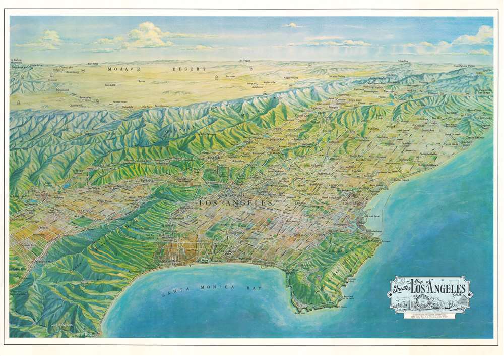
Map of Greater Los Angeles, Calif.
1970 (undated) 19.5 x 28.5 in (49.53 x 72.39 cm)
1970 (undated) 19.5 x 28.5 in (49.53 x 72.39 cm)
Description
This is a 1970 Jack H. Moffett bird's-eye view map of greater Los Angeles, California. Santa Monica Bay and the Palos Verdes Hills occupy the foreground with Los Angeles and its many suburbs spreading out between the coast and the San Gabriel Mountains. Cities are identified throughout, with major highways and roads between illustrated. The view stretches east from the San Gabriel Mountains across the Mojave Desert. Death Valley and Las Vegas are labeled on the horizon.
Publication History and Census
This view was created by Jack H. Moffett and published by Cooper Enterprises in 1970. We note eleven examples cataloged in OCLC including in the collections at the Library of Congress, the University of Illinois Urbana Champaign, and the Huntington Library. We also note an example at the David Rumsey Map Collection.Condition
Very good.
References
Rumsey 11886.000. OCLC 906600681.