This item has been sold, but you can get on the Waitlist to be notified if another example becomes available, or purchase a digital scan.
1910 Humitsch Map or Plan of New York City and Vicinity, New York
GreaterNewYork-humitsch-1910$125.00

Title
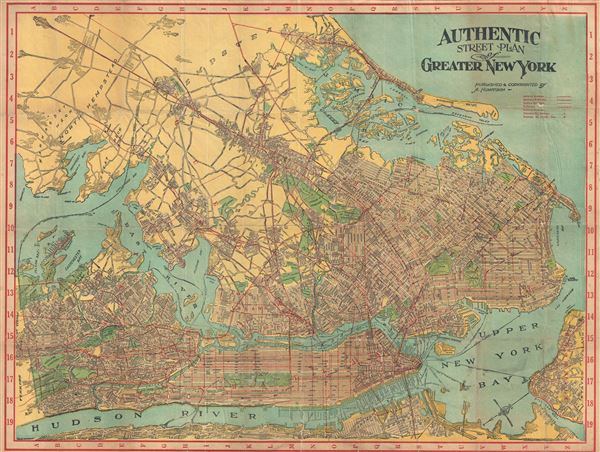
Authentic Street Plan of Greater New York.
1910 (undated) 26 x 35 in (66.04 x 88.9 cm) 1 : 42000
1910 (undated) 26 x 35 in (66.04 x 88.9 cm) 1 : 42000
Description
This is a beautiful c.1910 map of New York City and vicinity by A. Humitsch. It covers the greater New York area from Yonkers south to the Kill Van Kull and from Weehawken to Hempstead and includes the boroughs of Manhattan, Bronx, Brooklyn, Queens and parts of Staten Island as well as parts of New Jersey, North Hempstead and Hempstead. Throughout, the map identifies individual streets, avenues, parks, piers, ferry lines, bridges and other topography. Railway lines are marked in red. Verso contains a street index. This map was published and copyrighted by A. Humitsch and engrave by W. J. Bormay of the Bormay Engraving Company. The cover indicates the map was published as 'Wehman Bros. indexed Street Map Greater New York Shows all Streets in Manhattan, Bronx, Brooklyn and Queens Boroughs' and is published by Wehman Bros., 158 Park Row, New York.
Condition
Very good. Minor wear and creasing along original fold lines. Overall toning. Professionally flattened and backed with archival tissue. Accompanied by original paper binder.