This item has been sold, but you can get on the Waitlist to be notified if another example becomes available, or purchase a digital scan.
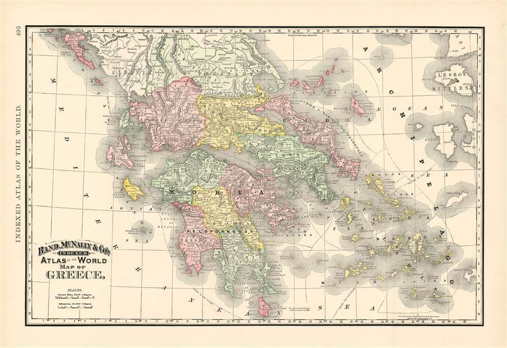
1892 Rand McNally Map of Greece and the Archipelago
Greece-randmcnally-1892$37.50

Title
Map of Greece.
1892 (dated) 13 x 20 in (33.02 x 50.8 cm) 1 : 1470000
1892 (dated) 13 x 20 in (33.02 x 50.8 cm) 1 : 1470000
Description
This is Rand McNally and Company's 1892 map of Greece. It covers from Corfu to Cythera and includes the Cyclades. Territories are distinguished from one another with original wash color, and topographical detail is shown with hachure. Greece gained independence from the Ottoman empire in 1832 under the Treaty of Constantinople; independence was followed by decades of internal conflict over topics ranging from constitutional issues to questions of which version of the Greek would be 'official.' All Greeks were united, however, in their determination to liberate the Hellenic lands under Ottoman rule. These efforts were playing out diplomatically over the period leading up to the production of this map: the cession of the Ionian Islands to Greece in 1864 is noted on the map. In 1897, five years after the publication of this map, Greece would declare war on the Ottomans Empire over control over Crete.
Publication History and Census
This map was issued as plate no. 495 in the Rand McNally and Company's Indexed Atlas of the World - possibly the finest atlas Rand McNally ever issued.Cartographer
Rand, McNally and Co. (fl. 1856 - present) is an American publisher of maps, atlases and globes. The company was founded in 1856 when William H. Rand, a native of Quincy, Massachusetts, opened a print shop in Chicago. Rand hired the recent Irish immigrant Andrew McNally to assist in the shop giving him a wage of 9 USD per week. The duo landed several important contracts, including the Tribune's (later renamed the Chicago Tribune) printing operation. In 1872, Rand McNally produced its first map, a railroad guide, using a new cost effective printing technique known as wax process engraving. As Chicago developed as a railway hub, the Rand firm, now incorporated as Rand McNally, began producing a wide array of railroad maps and guides. Over time, the firm expanded into atlases, globes, educational material, and general literature. By embracing the wax engraving process, Rand McNally was able to dominate the map and atlas market, pushing more traditional American lithographic publishers like Colton, Johnson, and Mitchell out of business. Eventually Rand McNally opened an annex office in New York City headed by Caleb S. Hammond, whose name is today synonymous with maps and atlases, and who later started his own map company, C. S. Hammond & Co. Both firms remain in business. More by this mapmaker...
Source
Rand McNally and Co., Indexed Atlas of the World (Complete in Two Volumes)…, (Chicago) 1892.
Condition
Very good. Text on verso.
References
Rumsey 3565.022 (1897 edition). Philips (atlases) 1026 (1898 edition).