This item has been sold, but you can get on the Waitlist to be notified if another example becomes available, or purchase a digital scan.
1867 Beers Map of Westchester (White Plains, Scarsdale, Hastings), New York
Greenburgh2-beers-1867$112.50

Title
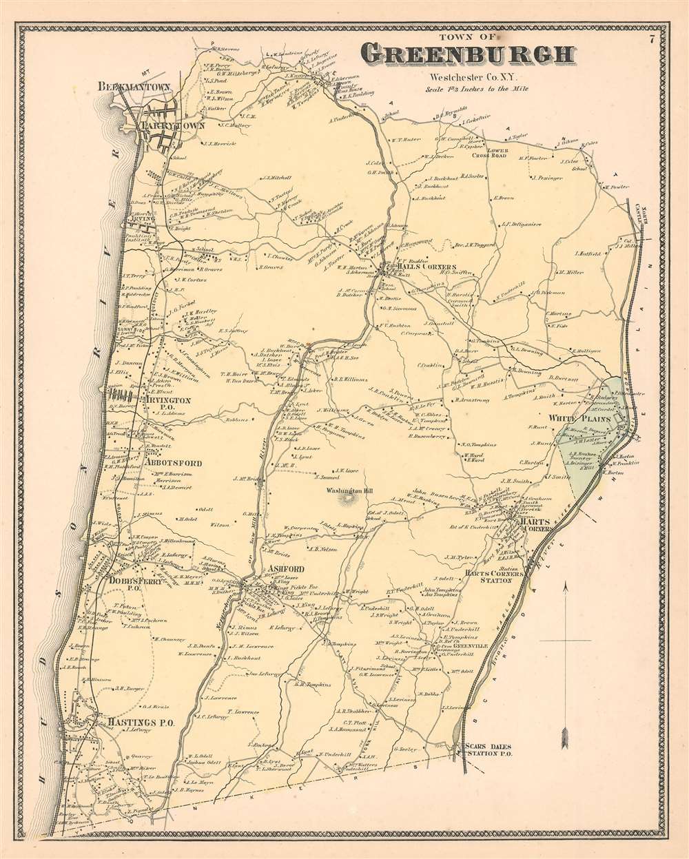
Greenburgh Westchester Co. N.Y.
1867 (undated) 13.25 x 16.5 in (33.655 x 41.91 cm) 1 : 39600
1867 (undated) 13.25 x 16.5 in (33.655 x 41.91 cm) 1 : 39600
Description
This is the scarce Greenburgh sheet from Beers' 1867 Atlas of Westchester County, New York. When this map was produced 'Greenburgh' consisted of what is today the central Westchester County. Includes White Plains, Scarsdale, Hastings, Dobbs Ferry, Abbotsford, Irvington, Irving, Hall's Corners, Ashford, and other communities between the Harlem River and the Hudson River. Indicates the Croton Aqueducts, the Saw Mill River, and the Sprain Brook. The extraordinary detail of this map, down to individual households with family names, make it a fascinating study for the family researcher or historian.
Publication History
This map was created and published by the Beers' family in their 1867 Atlas of Westchester County, New York.Cartographer
The Beers family (Fredrick, Silas, James and Daniel) (fl. c. 1850 - 1886), along with Charles and Augustus Warner, were prominent map publishers working from the 1850s to the late 1880s. Often publishing under the Warner & Beers designation, the combined firms produced a series of important state and county atlases and map of much of the northeastern United States. Many of their regional maps are among the most detailed and well laid out maps ever produced of their respective regions. Because Warner & Beers county maps were often detailed down to the individual homes and landowners, they have become highly sought after by general and family historians. In additional to producing maps of surpassing detail, Warner & Beers also maintained an earlier generation's attention to detail and quality while publishing in an era ever increasingly dominated by the low cost printing methods used by the publishing empires of Rand McNally and George Cram. More by this mapmaker...
Source
Beers, F. W., Atlas of New York and Vicinity, 1867.
Condition
Very good. Even overall toning. Blank on verso.
References
OCLC 50196628.