1780 Bellin Map of Guadeloupe and Marie-Galante
Guadeloupe-bellin-1780$350.00

Title
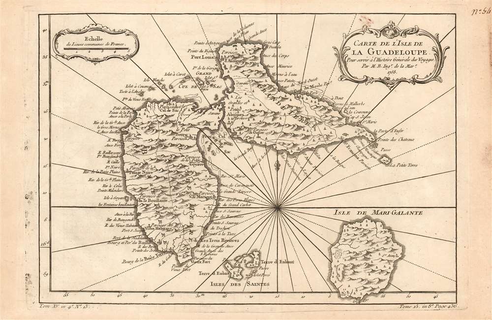
Carte de l'Isle de La Guadeloupe Pour servir à l'Histoire Générale des Voyages Par M. B. Ing.r de la Mar.e 1758.
1780 (dated) 8.25 x 12 in (20.955 x 30.48 cm) 1 : 500000
1780 (dated) 8.25 x 12 in (20.955 x 30.48 cm) 1 : 500000
Description
This is a 1758 Bellin map of the Caribbean islands of Guadeloupe and Marie-Galante, drawn one year before the British occupation of the archipelago during the Seven Years' War. The British would hold Guadeloupe and Marie-Galante from 1759 British until the 1763 Treaty of Paris. British rule of the archipelago had the effect of making the archipelago's European colonists wealthy, as it opened markets in British North America to Guadeloupean sugar. In turn, this led to the forced relocation and enslavement of 18,000 Africans to meet the demand for sugar production. In the 1763 Treaty of Paris, now considering Guadeloupe a colonial prize, France would give up its Canadian colonies in exchange for Guadeloupe.
Publication History and Census
The map was included in Harpe's 1780 abridged edition of Prévost's Histoire générale des voyages. This map appears on the market from time to time, but OCLC lists only three copies of the separate map (although inconsistencies in cataloguing mean this number may be higher.) Prévost's Histoire and Harpe's abridged version of it are well represented in institutional collections.Cartographer
Jacques-Nicolas Bellin (1703 - March 21, 1772) was one of the most important cartographers of the 18th century. With a career spanning some 50 years, Bellin is best understood as geographe de cabinet and transitional mapmaker spanning the gap between 18th and early-19th century cartographic styles. His long career as Hydrographer and Ingénieur Hydrographe at the French Dépôt des cartes et plans de la Marine resulted in hundreds of high quality nautical charts of practically everywhere in the world. A true child of the Enlightenment Era, Bellin's work focuses on function and accuracy tending in the process to be less decorative than the earlier 17th and 18th century cartographic work. Unlike many of his contemporaries, Bellin was always careful to cite his references and his scholarly corpus consists of over 1400 articles on geography prepared for Diderot's Encyclopedie. Bellin, despite his extraordinary success, may not have enjoyed his work, which is described as "long, unpleasant, and hard." In addition to numerous maps and charts published during his lifetime, many of Bellin's maps were updated (or not) and published posthumously. He was succeeded as Ingénieur Hydrographe by his student, also a prolific and influential cartographer, Rigobert Bonne. More by this mapmaker...
Source
De la Harpe, Abrégé de l'histoire générale des voyages. (Paris) 1780.
Condition
Very good condition; some staining to right margin away from image. Else excellent with a bold strike and generous margins.
References
OCLC 1105710572.