This item has been sold, but you can get on the Waitlist to be notified if another example becomes available, or purchase a digital scan.
1886 Bianconi Map of Guatemala
Guatemala-bianconi-1886$1,200.00

Title
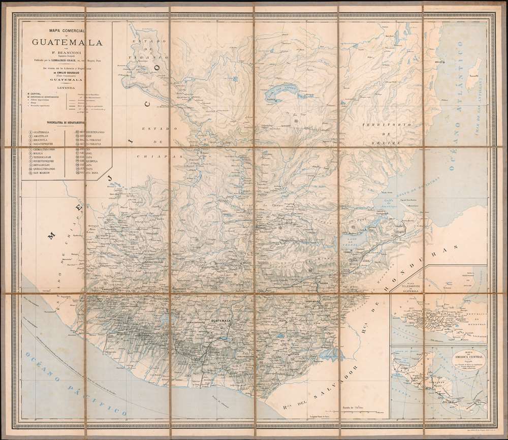
Mapa Comercial de Guatemala.
1886 (undated) 31.5 x 26.5 in (80.01 x 67.31 cm) 1 : 750000
1886 (undated) 31.5 x 26.5 in (80.01 x 67.31 cm) 1 : 750000
Description
This is a rare separately issued F. Bianconi map of Guatemala. The map depicts the region from Mexico to the Atlantic Ocean and from Tikal to El Salvador. Highly detailed, myriad cities, towns, and villages are labeled throughout. Roads, railroads, lakes, and rivers are also illustrated and labeled. Guatemala's twenty-two departments are also presented and all twenty-two are listed in the key situated in the upper left corner. Two inset maps are situated in the lower right corner. One depicts the telegraph network in Guatemala in detail and the other illustrates the roads, telegraph lines, and underwater cables in Central America.
Cartographer
F. Bianconi (fl. c. 1870 - 1900) was a cartographer active in France during the late 19th century. He prepared a series of maps of South American countries, including Colombia and Equador, Bolivia, Venezuela, Chile, and Uruguay and Argentina. More by this mapmaker...
Condition
Very good. Dissected and mounted on linen in eighteen panels. Blank on verso.