This item has been sold, but you can get on the Waitlist to be notified if another example becomes available, or purchase a digital scan.
1873 U.S. Navy Hydrographic Office Chart / Map of Florida and the Bahamas
GulfofFlorida-navy-1873$1,400.00


Title
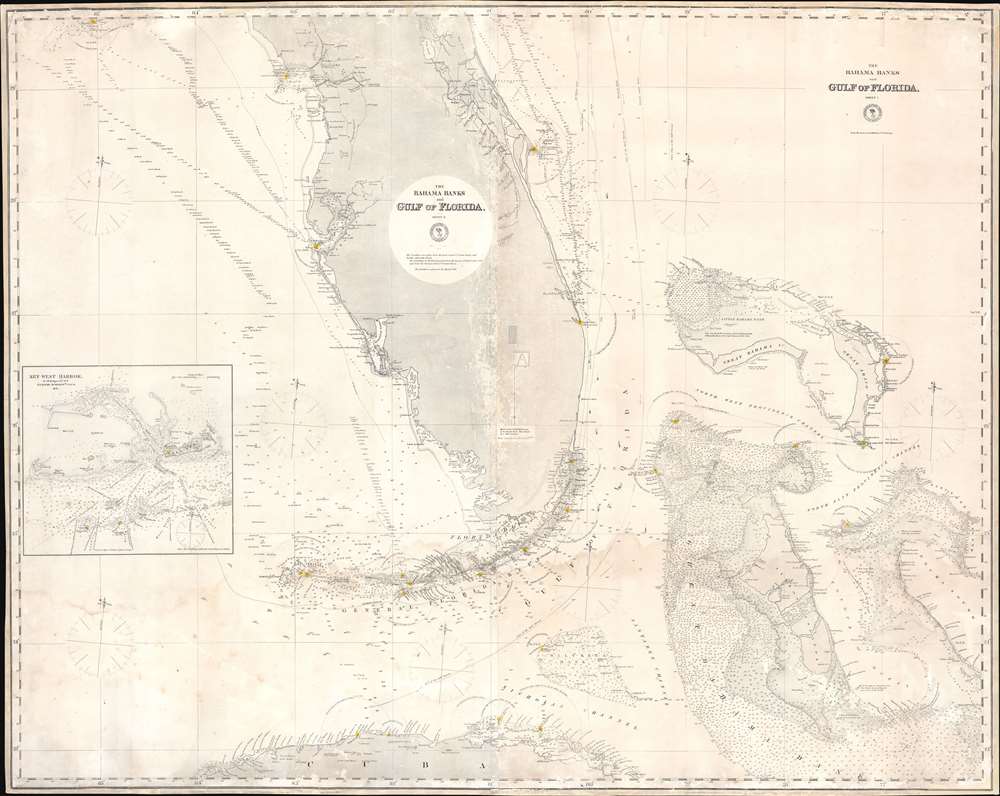
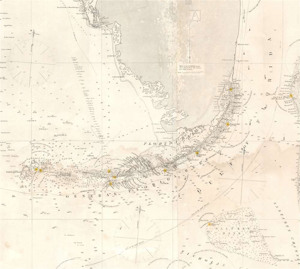
The Bahama Banks and Gulf of Florida, Sheet 1.
1873 (dated) 39.5 x 50 in (100.33 x 127 cm) 1 : 910000
1873 (dated) 39.5 x 50 in (100.33 x 127 cm) 1 : 910000
Description
A most uncommon 1873 U.S. Navy Hydrographic Office nautical chart or maritime map of Florida and the Bahamas. Coverage embraces the lower two-thirds of peninsular Florida, the Florida Strait as far as Cuba, and the northern Bahamas. An inset in the lower left details Key West and it's vicinity from the 1851 U.S. Cost Survey of J. R. Rodgers. The Bahamas are superbly detailed with thousands of soundings - underscoring the danger of navigating these shallow waters. This chart follows in the lineage of Edmund March Blunt's great chart of 1844 - and is indicative of that commercial cartographer's long-standing influence on official naval chart making.
Elliott's Beach - Miami
Where Miami now stands, on the mainland west of the Cape Florida Light, 'Elliots Beach' is labeled. Although no one knows for certain, it is believed that this was the camp used by surveyor Andrew Ellicott (1754 - 1820), a titanic figure in early American surveying who mapped the Florida coast around the turn of the 19th century. Elliot's Key, nearby, is also believed to be named after Ellicott - both sharing the same unfortunate error of the 'c' being omitted from the surveyor's name. Another theory suggests the name was an honorific to Gilbert Elliott, an English treasury official assigned by John Gerar William De Brahm (1711 -1799), who surveyed this coast in the 1760. We find this unlikely as we can find Elliott on none of De Brahm's maps while we can find a key in roughly the same location named after James Oswald, Elliott's chief rival in the royal court.Publication History and Census
This chart was first published by the U.S. Navy Hydrographic Office in 1868. It was updated in 1872 and again, as here in 1873. Rare. We note no examples of this chart in the OCLC and know of none in private hands.Cartographer
United States Hydrographic Office (1866 - 1962) was a brach of he U.S. Navy that prepared and published maps, charts, and nautical books to aid in navigation. Before the establishment of the Hydrographic Office in 1866, U.S. navigators were almost entirely dependent on British charts. There had been a few private enterprises that had prepared and published charts, but none had been able to do so profitably. The Office was established 'for the improvement of the means of navigating safely the vessels of the Navy and of the mercantile marine, by providing, under the authority of the Secretary of the Navy, accurate and cheap nautical charts, sailing directions, navigators, and manuals of instructions for the use of all vessels of the United States, and for the benefit and use of navigators generally.' This way the Navy Department could furnish navy and merchant ships with charts illustrating the results of surveys and explorations undertaken by naval officers. The charts were priced to cover the cost of paper and printing alone, not preparation. Its main objective was to survey foreign coasts, as the Coast and Geodetic Surveys were responsible for surveying domestic waters. The Hydrographic Office was transferred from the Department of the Navy to the Department of Defense in 1949 and was replaced by the Naval Oceanographic Office in 1962. More by this mapmaker...
Condition
Good. Laid down on fresh linen. Some scuffing. Minor dampstaining.