1958 U.S. Air Force Aeronautical Chart or Map of Hainan Island, China
HainanIsland-usaf-1958$100.00

Title
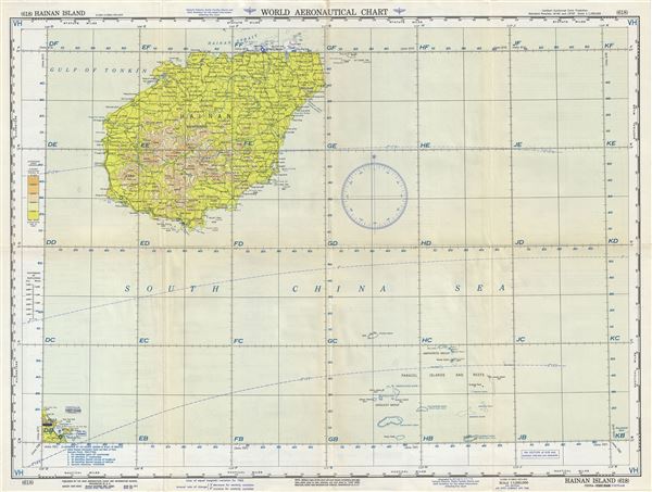
Hainan Island China-Vietnam.
1958 (dated) 22 x 29 in (55.88 x 73.66 cm) 1 : 1000000
1958 (dated) 22 x 29 in (55.88 x 73.66 cm) 1 : 1000000
Description
This is a scarce 1958 U.S. Aeronautical chart or map of Hainan Island, China. It covers the smallest and southernmost province of China, Hainan in its entirety and south as far as the Paracel Islands and Reefs. Vietnam's Da Nang Bay is also included in the lower left quadrant. The map is highly detailed and notes important cities, towns, rivers, roads as well as other hydrographical and topographical features essential for the air pilot. Verso of this chart features legends and a world aeronautical chart index. This chart was published by the USAF Aeronautical Chart and Information Service, Washington 25, D.C., and was issued as chart no. 617. First issued in 1948, this is the sixth edition revised to May 1954.
Condition
Very good. Minor wear and toning along original fold lines. Minor spotting.