This item has been sold, but you can get on the Waitlist to be notified if another example becomes available, or purchase a digital scan.
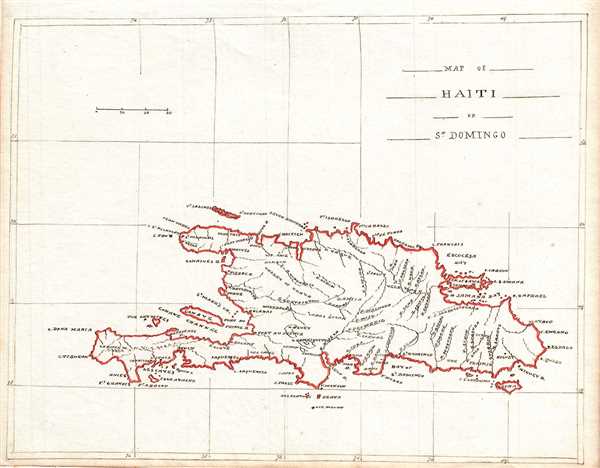
1835 Manuscript Map of Hispaniola or Santo Domingo, West Indies
Haiti-manuscript-1835$125.00

Title
Map of Haiti or St. Domingo.
1835 (undated) 7.5 x 9.5 in (19.05 x 24.13 cm) 1 : 3300000
1835 (undated) 7.5 x 9.5 in (19.05 x 24.13 cm) 1 : 3300000
Description
This is a beautiful c.1835 manuscript map of the island of Santo Domingo (St. Domingo) or Hispaniola. It covers the entire island with striking outline color. Identifies cities, towns, rivers and surroundings smaller islands. Today this island is divided between the Dominican Republic and Haiti. Features fine calligraphy.
Condition
Very good. Manuscript map. Minor spotting in margins.