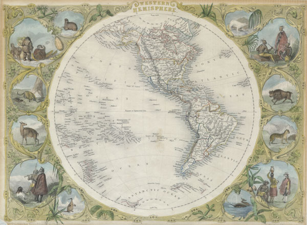
This is an extremely attractive full color example of John Tallis' decorative map of the Western Hemisphere. Covers both North and South America as well as parts of Polynesia, Antarctica, and Siberia. Shows Texas as both part of and separate from the United States, with a faint but uncolored border – which none of the other states and territories have. Antarctica drawn in only sketchily. Near the southern tip of South America the mythical Aurora Islands are shown. The Aurora Islands were a group of three islands first reported in 1762 by the Spanish ship Aurora while sailing from Lima to Cádiz. They were subsequently and repeatedly sighted several times over the next 90 years. The last official sighting was 1852, after which they were ascribed to myth. No one knows if the Aurora Islands every really existed, but they do continue to appear on maps well into the mid 19th century. In any case, this beautiful map is surrounded by and elaborate border and 12 full color vignettes depicting the flora, fauna, and peoples of the Western Hemisphere. Vignettes show American Indians, an alpaca, walruses, a bison, a whale, Inuit peoples, and a great polar bear, among others. Possibly the most beautiful map of its type to appear in the 19th century. The illustrations were drawn by H. Warren and J. Rogers. The map was drawn and engraved by J. Rapkin for the 1851 issue of Tallis and Montgomery's The Illustrated Atlas, And Modern History Of The World Geographical, Political, Commercial & Statistical. This Illustrated Atlas… was one of the last decorative atlases of the 19th century.
Cartographer
John Tallis and Company (1838 - 1851) published views, maps, and atlases in London from roughly 1838 to 1851. Their principal works, expanding upon the earlier maps of John Cary and Aaron Arrowsmith, include an 1838 collection of London Street Views and the 1849 Illustrated Atlas of the World. The firm’s primary engraver was John Rapkin, whose name and decorative vignettes appear on most Tallis maps. Due to the embellishments typical of Rapkin's work, many regard Tallis maps as the last bastion of English decorative cartography in the 19th century. Although most Tallis maps were originally issued uncolored, it was not uncommon for 19th century libraries to commission colorists to "complete" the atlas. The London Printing and Publishing Company of London and New York bought the rights for many Tallis maps in 1850 and continued issuing his Illustrated Atlas of the World until the mid-1850s. Specific Tallis maps later appeared in innumerable mid to late-19th century publications as illustrations and appendices. More by this mapmaker...
Good condition. Minor acid tranferrence from old mat around outside margin. Minor marginal repair lower left quadrant.
Rumsey 0466.005. Phillips (Atlases) 804-4.


