This item has been sold, but you can get on the Waitlist to be notified if another example becomes available.
1964 Dudley Chase Pictorial Map of Massachusetts (1964 World's Fair Issue)
HistoricMassachusetts-chase-1964$175.00

Title
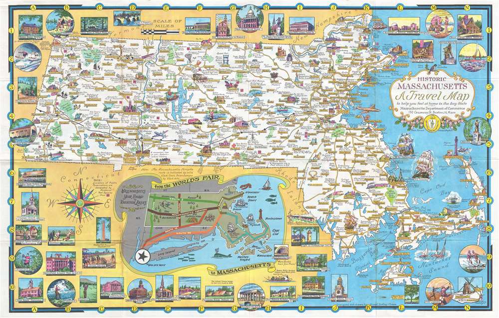
Historic Massachusetts: A Travel Map to help you feel at home in the Bay State.
1964 (undated) 21 x 33.5 in (53.34 x 85.09 cm) 1 : 380160
1964 (undated) 21 x 33.5 in (53.34 x 85.09 cm) 1 : 380160
Description
One of Ernest Dudley Chase's less common pictorial maps, this map of Massachusetts was created for the Massachusetts Pavilion at the 1964 New York World's Fair. Charmingly illustrated with eye-catching color, the map highlights the sightseeing opportunities of the Bay State. Historic buildings throughout are illustrated in profile and in the vignettes that frame the map. Historic ships, such as the Mayflower and Old Ironsides, ply the waters off the Massachusetts coast. An inset along the bottom border illustrates routes to tempt travelers into a side trip to Massachusetts after visiting the World's Fair, highlighting Boston, Plymouth, and in particular the New Bedford Whaling Museum, which had lent a 175-foot section of the famous 1,295-foot-long Whaling Panorama to the New England Pavilion restaurant. Numerous vignettes highlight activities available to the visitor, such as fishing, golfing, horseback riding, and boating. Historic sites from around the state, including Springfield Armory, Faneuil Hall in Boston, and the Bunker Hill Monument in Charlestown are noted for the less sporty tourist.
Massachusetts and the 1964 World's Fair
At the 1964 World's Fair, the six New England states – Maine, New Hampshire, Vermont, Massachusetts, Rhode Island, and Connecticut - collaborated on a pavilion. Each state had its own exhibition space, known as the 'Court of States'. The pavilion also featured a 'village green' where groups from different New England communities held dances, musical performances, and fashion shows. New England-made products were sold to fairgoers at the Country Store, and a restaurant served typical dishes.Publication History and Census
This map was created by Ernest Dudley Chase for distribution at the Massachusetts pavilion during the 1964 New York World's Fair. There are at least two known editions of this map. The present edition and another that includes an inset map of the greater Boston area. This special edition for the New York World's Fair is scarce, as we have been able to locate only one other known example, in the collection of the Norman B. Leventhal Map Center at the Boston Public Library.Cartographer
Ernest Dudley Chase (July 26, 1878 - August 25, 1966) was an American illustrator of greeting cards and pictorial maps active in the first half of the 20th century. From his studio in Winchester, Massachusetts, Chase became famous for his elaborately illustrated pictorial maps. He was born in Lowell, Massachusetts, and attended the Lowell Textile School and the Vesper George Art School. He took work with Butterfield Printing Company in 1900. In 1906, he moved to the W. T. Sheehan Printing Firm. He began producing postcards and greeting cards on his own account in 1908. This initial imprint was Des Arts Publishers, but later, he changed it to Ernest Dudley Chase Publishers. Chase is best known today for his distinctive pictorial maps, most of which he published privately, characterized by dense vignette images of important locations. The biographical pamphlet A Meticulous Maker of Maps describes Chase's attention to detail wherein, pursuing a 'passion for perfection' by stippling his images 'dot-by-dot, with tiny pens' under a magnifying glass. His impressive corpus includes nearly 50 maps focusing on various parts of the United States and Europe, as well as other international locations and novelty pieces. Most are thematic, focusing on topics such as wonders of the world, stamps, aviation, and war. Others, such as his map of The United States as viewed by California and Loveland are satirical. All, in their original editions, are coveted by a dedicated following of modern collectors. More by this mapmaker...
Condition
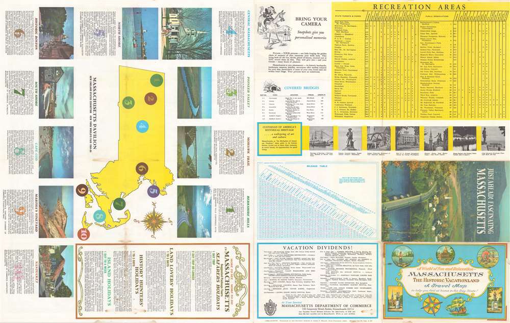
Very good. Even overall toning. Light wear along original fold lines. Text and other content on verso.
References
Boston Public Library, Leventhal Center, #G3761.E635 1964 .C43.