This item has been sold, but you can get on the Waitlist to be notified if another example becomes available, or purchase a digital scan.
1827 Finley Map of Holland or the Netherlands
Holland-finley-1827-2$75.00

Title
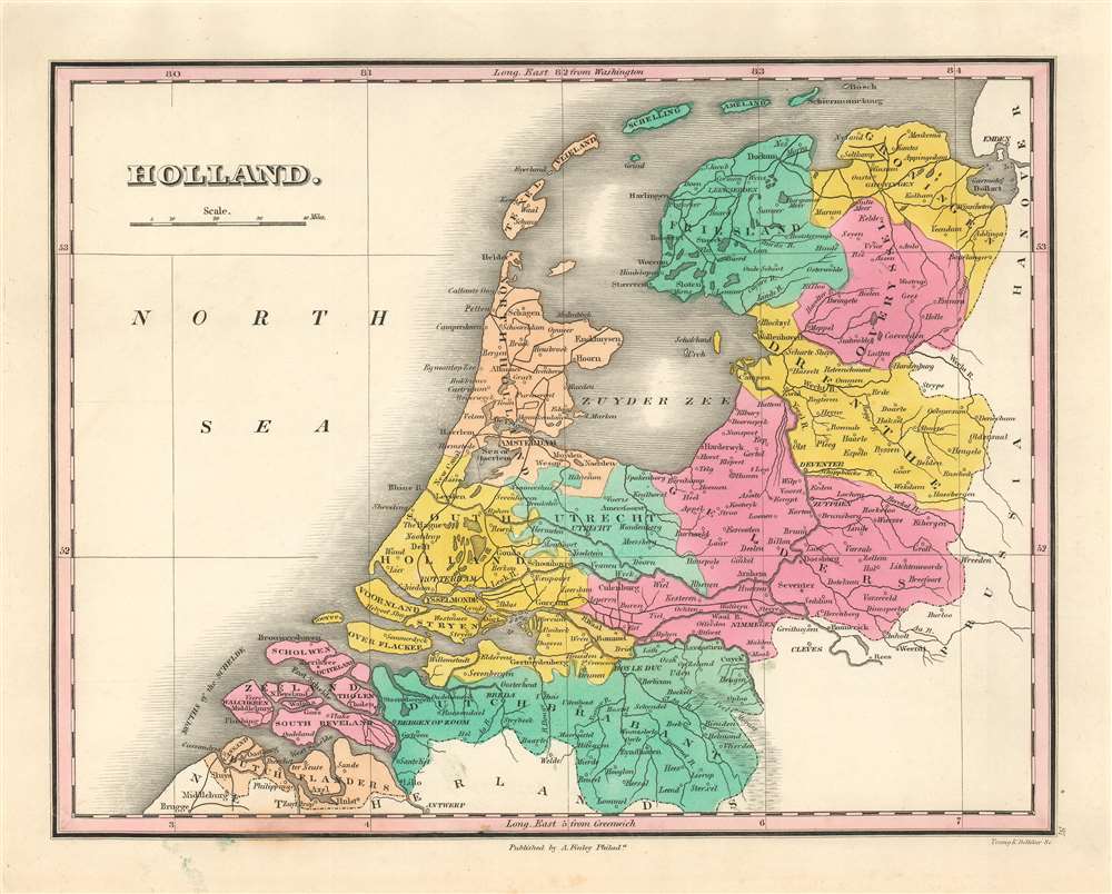
Holland.
1827 (undated) 8.5 x 11 in (21.59 x 27.94 cm) 1 : 1300000
1827 (undated) 8.5 x 11 in (21.59 x 27.94 cm) 1 : 1300000
Description
A beautiful example of Finley's important 1827 map of Holland, or the Netherlands. The map embraces the region Friesland south to Dutch Flanders and Brabant. Identifies numerous cities, including Amsterdam, Antwerp, and Bergen op Zoom. The map also shows and names river systems, swamps and canals. A simple, elegant title and scale appear in the upper left quadrant.
Publication History and Census
The map was engraved by Young and Delleker for the 1827 edition of Anthony Finley's New General Atlas. The map appears on the market from time to time, but is neglected in institutional collections. Although catalogued in OCLC, the separate map is not indicated in any location; OCLC lists only nine institutions with the whole New General Atlas.Cartographer
Anthony Finley (August 25, 1784 - June 9, 1836) was an American book and map publisher based in Philadelphia, Pennsylvania. Finley was born in Philadelphia in 1784. He opened a bookshop and publishing house at the Northeast corner of Fourth and Chestnut Street, Philadelphia in 1809. His earliest known catalog, listing botanical, medical and other scientific works, appeared in 1811. His first maps, engraved for Daniel Edward Clarke’s Travels in Various Countries of Europe, Asia, and Africa also appear in 1811. His first atlas, the Atlas Classica, was published in 1818. He soon thereafter published the more significant A New American Atlas and the New General Atlas…, both going through several editions from 1824 to 1834. Although most of Finley's cartographic material was borrowed from European sources, his atlases were much admired and favorably reviewed. In addition to his work as a printer, Finley ran unsuccessfully on the 1818 Democratic ticket for Philadelphia Common Council. He was a founding officer of the Philadelphia Apprentices’ Library, and a member of both the American Sunday-School Union and the Franklin Institute. He was also an ardent supporter of the American Colonization Society, an organization dedication to returning free people of color to Africa - which led to the founding of Liberia. Much of his wealth was dedicated to supporting this cause. Finley was active as a publisher until his 1836 death, apparently of a 'lingering illness.' Shortly thereafter advertisements began appearing for his map business and plates, most of which were acquired by Samuel Augustus Mitchell. More by this mapmaker...
Source
Finley, A. A new general atlas. (Philadelphia : Anthony Finley) 1827.
Condition
Very good condition. Original platemark with generous margins, and original wash color. Blank on verso.
References
OCLC 13028532. Rumsey 0285.038 (1831 edition). Phillips (Atlases) 4314, 760, 752, 6045.