1957 Dah Chung Book Company Map of Hong Kong and Kowloon
HongKongKowloon-dahchung-1957$750.00

Title
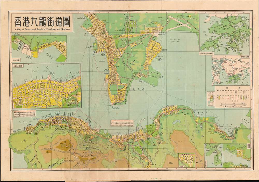
香港九龍街道圖 / A Map of Streets and Roads in Hong Kong and Kowloon.
1957 (dated) 21.75 x 31 in (55.245 x 78.74 cm) 1 : 17500
1957 (dated) 21.75 x 31 in (55.245 x 78.74 cm) 1 : 17500
Description
This is a 1957 Dah Chung Book Company bilingual Chinese and English city plan or map of Hong Kong and Kowloon, China. Depicting the Kowloon Peninsula and the northern coast of Hong Kong, streets are labeled in both languages, along with bays, parks, and other locations. Colors highlight urban areas and indicate the region's topography and ocean depth. Numerous insets are included along the borders and illustrate the entire Hong Kong region, situate Hong Kong with relation to regional cities in China, and detail areas of Hong Kong including Dakeng, Central and Sheung Wan, and Lychee Corner.
Publication History and Census
This map was created and published by the Da Chung Book Company in 1957 in Hong Kong. It is not cataloged in OCLC.Cartographer
The Dah Chung Book Company (fl. c. 1955 - c. 1977) was a publishing house active in Hong Kong during the mid-20th century. They published books and maps. We have been unable to locate more information concerning this firm. More by this mapmaker...
Condition
Good. Exhibits wear and toning along original fold lines. Light soiling. Bilingual Chinese and English index printed on verso. Attached to original binder.