This item has been sold, but you can get on the Waitlist to be notified if another example becomes available, or purchase a digital scan.
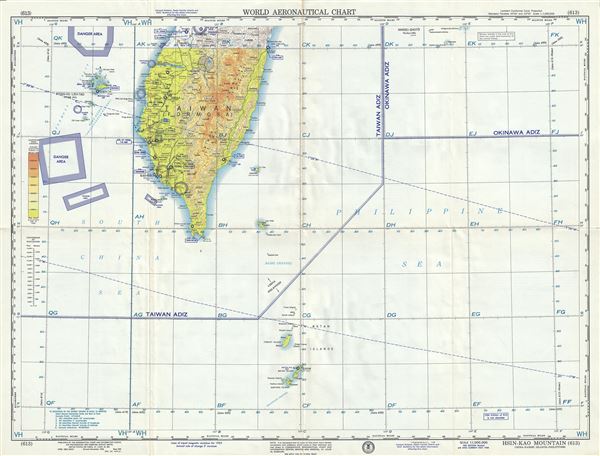
1958 U.S. Air Force Aeronautical Chart or Map of Southern Taiwan
HsinKaoMountain-usaf-1958$50.00

Title
Hsin-Kao Mountain China-Nansei Islands-Philippines.
1958 (dated) 22 x 29 in (55.88 x 73.66 cm) 1 : 1000000
1958 (dated) 22 x 29 in (55.88 x 73.66 cm) 1 : 1000000
Description
This is a scarce 1958 U.S. Air Force aeronautical chart or map of southern Taiwan or Formosa Island, focusing on the Hsin-Kao Shan region. It covers southern Taiwan from Tai Chung south to Batnan Island. The map is highly detailed and notes danger areas, important cities, towns, rivers, roads as well as other hydrographical and topographical features essential for the air pilot. Verso of this chart features legends and a world aeronautical chart index. This chart was published by the USAF Aeronautical Chart and Information Center, and was issued as chart no. 613. First issued in 1953, this is the tenth edition revised to Nov 1958.
Condition
Very good. Minor wear and toning along original fold lines. Minor spotting.