1943 Dade County Newsdealers Bird's Eye View Map of Miami Beach and Miami, Florida
InandOutMiami-dadeconewsdealers-1943$250.00


Title
'In and Out' Map of Miami Miami Beach Coral Gables and Vicinity.
1943 (dated) 19.75 x 31.5 in (50.165 x 80.01 cm)
1943 (dated) 19.75 x 31.5 in (50.165 x 80.01 cm)
Description
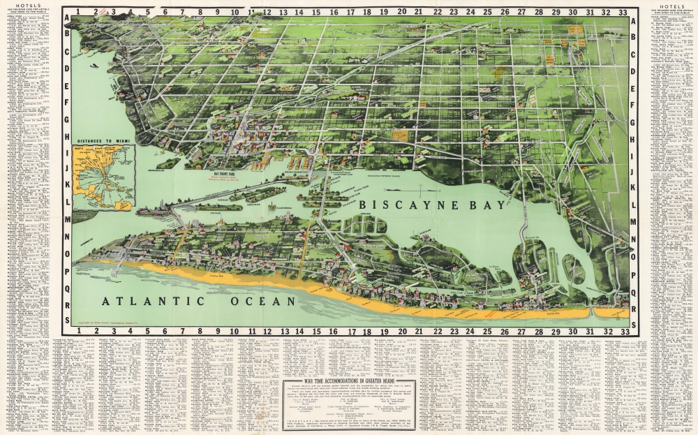
This is a 1943 Dade County News Dealers Supply Company bird's-eye view map of Miami and Miami Beach, Florida. It illustrates Miami during World War II (1939 - 1945), when nearly half a million men, including matinee idol Clark Gable, were stationed there for training by the Army Air Forces Technical Training Command.
A Closer Look
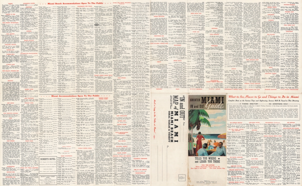
The map looks west over Miami and Miami Beach from above the Atlantic, placing Miami Beach in the foreground. Individual streets in both Miami and Miami Beach are labeled, including Ocean Drive and Collins Avenue in Miami Beach, and East and West Flagler Street and Biscayne Boulevard in Miami. Schools, businesses, hospitals, country clubs, and other locations are illustrated in profile and identified, perhaps most notably the University of Miami and the Orange Bowl. Star Island, Palm Island, Hibiscus Island, Belle Isle, and the Venetian Islands are illustrated in Biscayne Bay as are the causeways connecting Miami and Miami Beach. An inset map along the left illustrates the air distances between Miami and cities across the United States, the Caribbean, and Central America. An index of 'wartime accommodations in Greater Miami' encircles the map on three sides, listing hotels in alphabetical order, along with their street addresses, phone numbers, and grid locations. Given that an index of Miami and Miami Beach hotels 'open to the public' occupies most of the verso, one can presume that the hotels on the recto are meant for service personnel or other individuals in Miami on war related contracts.Publication History
This map was published by the Dade County Dealers Supply Company in 1943. An example is part of the Touchton Map Library at the Tampa Bay History Center. We also note a cataloged example in OCLC which is part of the collection at the University of South Florida.Condition
Good. Wear along original fold lines. Slight loss at a few fold intersections. Text on verso.
References
Tampa Bay History Center Touchton Map Library 2019.005.013. OCLC 1100586787.