This item has been sold, but you can get on the Waitlist to be notified if another example becomes available, or purchase a digital scan.
1892 Rand McNally Map of India
India-randmcnally-1895$50.00

Title
Map of India.
1892 (dated) 27 x 20.5 in (68.58 x 52.07 cm)
1892 (dated) 27 x 20.5 in (68.58 x 52.07 cm)
Description
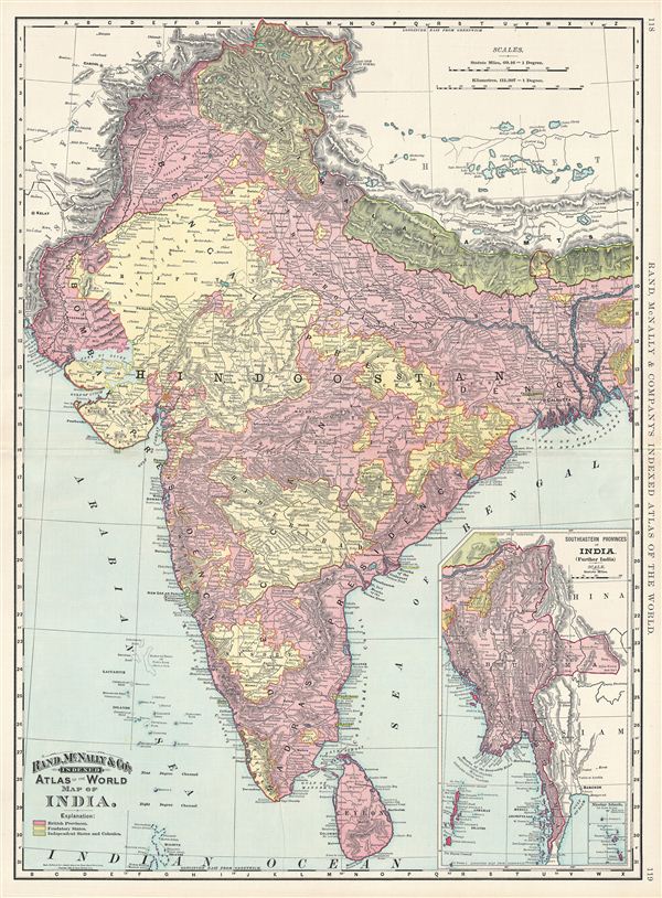
This is a beautiful example of Rand McNally and Company's 1892 map of India. It covers the entire subcontinent from Kashmir south to Ceylon (Sri Lanka) and from Sindh east to Assam. An inset in the lower right quadrant details the Southeastern Provinces of India (further India). Color coded according to British provinces, feudatory states, and Independent states and colonies, the map depicts most of what is today modern India and what was, when this map was made, British India. Following the Sepoy Revolt of 1857, the east India Company was dissolved and governance of India was administered directly by the British Crown. The British Raj ruled India until its independence in 1947. In 1885 the foundation of the Indian National Congress led the struggle for independence. The party still holds dominance in Indian politics and is the largest and one of the oldest democratic parties in the world. Rand McNally identifies numerous cities and towns, as well as noting rivers and various other topographical details. Relief shown by hachure. This map was issued as plate nos. 118 and 119 in the 1895 issue of Rand McNally and Company's Indexed Atlas of the World - possibly the finest atlas Rand McNally ever issued.
Cartographer
Rand, McNally and Co. (fl. 1856 - present) is an American publisher of maps, atlases and globes. The company was founded in 1856 when William H. Rand, a native of Quincy, Massachusetts, opened a print shop in Chicago. Rand hired the recent Irish immigrant Andrew McNally to assist in the shop giving him a wage of 9 USD per week. The duo landed several important contracts, including the Tribune's (later renamed the Chicago Tribune) printing operation. In 1872, Rand McNally produced its first map, a railroad guide, using a new cost effective printing technique known as wax process engraving. As Chicago developed as a railway hub, the Rand firm, now incorporated as Rand McNally, began producing a wide array of railroad maps and guides. Over time, the firm expanded into atlases, globes, educational material, and general literature. By embracing the wax engraving process, Rand McNally was able to dominate the map and atlas market, pushing more traditional American lithographic publishers like Colton, Johnson, and Mitchell out of business. Eventually Rand McNally opened an annex office in New York City headed by Caleb S. Hammond, whose name is today synonymous with maps and atlases, and who later started his own map company, C. S. Hammond & Co. Both firms remain in business. More by this mapmaker...
Source
Rand McNally & Co., Foreign Countries. Rand, McNally & Co's Indexed Atlas of the World (Complete in Two Volumes)…, (Chicago) 1895.
Condition
Very good. Original centerfold. Text on verso.
References
Rumsey 3565.032 (1897 edition). Philip (atlases) 1026 (1898 edition).