This item has been sold, but you can get on the Waitlist to be notified if another example becomes available, or purchase a digital scan.
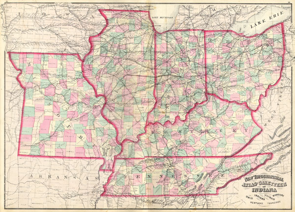
1873 Asher Adams Map of the Midwest ( Ohio, Indiana, Illinois, Missouri, Kentucky )
INILOHMOKTTN-aa-1873$65.00

Title
New Topographical Atlas and Gazetteer of Indiana, Ohio, Indiana, Illinois, Missouri, Kentucky, Tennessee.
1873 17 x 23 in (43.18 x 58.42 cm)
1873 17 x 23 in (43.18 x 58.42 cm)
Description
This is an 1874 Asher & Adams hand colored map of the Midwest and Central states of Ohio, Indiana, Illinois, Missouri, Kentucky and Tennessee.
Cartographer
Asher and Adams (fl. c. 1860 - c. 1900) were New York based cartographers active in the latter part of the 19th century. Active in the 1860s and 70s, the New York firm of Asher & Adams produced some of the most detailed and colorful late 19th century American Atlases. Asher & Adams are known for their remarkable state and county atlases which are so detailed that they include individual family homes and names. The Asher & Adams firm followed the quality and style formats pioneered by the earlier Colton and Johnson firms - notable for their distinctive pastel color washes and impressive size. Their most important work is their 1874 Asher & Adams Commercial and Statistical Gazetteer of the United States which is one of the first 19th century atlases to remove topographical information to make room for detailed depictions of railroads. More by this mapmaker...
Condition
Generally good or fine condition.