This item has been sold, but you can get on the Waitlist to be notified if another example becomes available, or purchase a digital scan.
1840 Black Map of Ireland in Counties
IrelandCounty-black-1840$75.00

Title
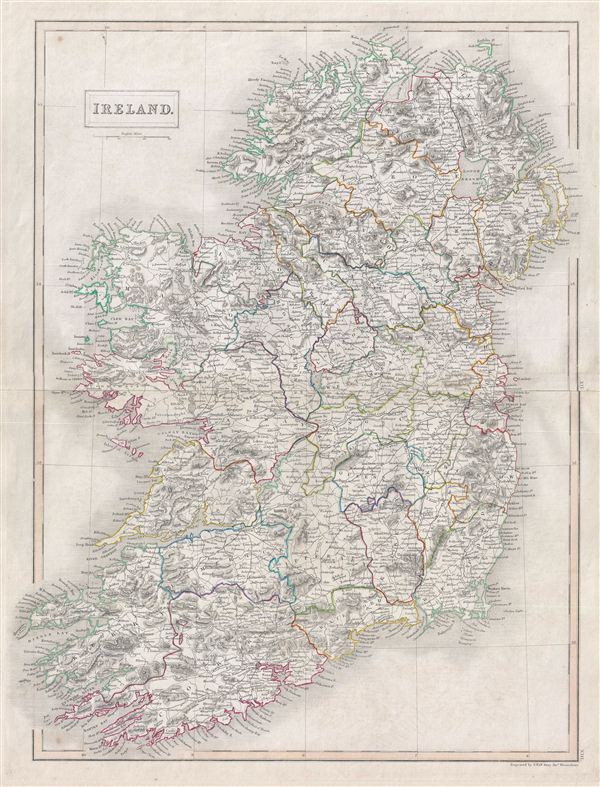
Ireland.
1840 (undated) 21 x 16.5 in (53.34 x 41.91 cm)
1840 (undated) 21 x 16.5 in (53.34 x 41.91 cm)
Description
A fine example of Adam and Charles Black's 1840 map of Ireland. The map shows all of Ireland divided by county. It covers from Donegal in the north to Cork in the south. In 1801, the island of Ireland became part of the United Kingdom of Great Britain and Ireland. Though Britain was flourished during this period, Ireland would witness the Great Irish Famine from 1845-1849 causing mass starvation and emigration. This map was engraved by S. Hall for issue in the 1840 edition of Black's General Atlas.
Cartographer
Charles and Adam Black (fl. 1807 - present) were map and book publishers based in Edinburgh. Charles and his uncle, Adam, both of Edinburgh, Scotland, founded their publishing firm in 1807. They published a series of maps and atlases throughout the 19th century. In addition to an array of atlases, the Black firm is known for their editions of the Encyclopedia Britannica (1817 - 1826) and the first publishing of Sir Walter Scott's novels in 1854. In 1889 the A. & C. Black publishing house moved to London where it remains in operation to this day. More by this mapmaker...
Source
Hall, Sydney, Black's General Atlas: A series of Fifty-Four Maps from the Latest and Most Authentic Sources, Engraved on Steel, In the First Style of the Art, (Edinburgh: Adam and Charles Black) 1840.
Condition
Very good. Blank on verso. Original platemark visible. Original centerfold.
References
Rumsey 2305.021 (1854 edition). Philips (atlases) 4334.