This item has been sold, but you can get on the Waitlist to be notified if another example becomes available, or purchase a digital scan.
1953 Washington Post Map of the Great Names of Ireland
IrishNames-washingtonpost-1953$87.50

Title
Great Names of the Irish.
1953 (dated) 22 x 15 in (55.88 x 38.1 cm) 1 : 820800
1953 (dated) 22 x 15 in (55.88 x 38.1 cm) 1 : 820800
Description
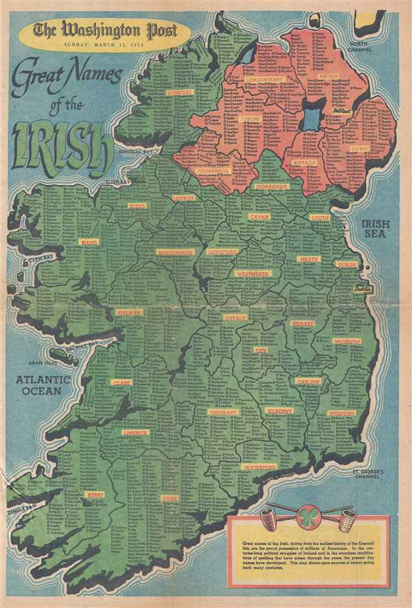
This is a 1953 Washington Post map of Ireland featuring Irish family names. The map depicts the entirety of the Emerald Isle from the North Channel to the Celtic Sea and from the Atlantic Ocean to the Irish Sea. Both Ireland and Northern Ireland are divided into counties, each of which is labeled. Irish counties are colored green, while Northern Irish counties are colored red. The capital cities of Northern Ireland (Belfast) and Ireland (Dublin) are the only labeled cities. The rest of the map is populated by the 'great names of the Irish', with each county filled by Irish family names whose lineage could be traced back to that specific county. A text box in the bottom right corner informs the viewer that 'this map draws upon sources of names going back many centuries' and is adorned with a shamrock and two pipes.
This map was drawn by Virgil V. Jackson and published in the Washington Post on Sunday, March 15, 1953.
This map was drawn by Virgil V. Jackson and published in the Washington Post on Sunday, March 15, 1953.
Source
Washington Post, Sunday March 15, 1953.
Condition
Very good. Original newsprint. Closed tear professionally repaired on verso. Text on verso.