This item has been sold, but you can get on the Waitlist to be notified if another example becomes available, or purchase a digital scan.
1680 Schenk and Valk Map of Iceland
Islandiae-valk-1680$450.00

Title
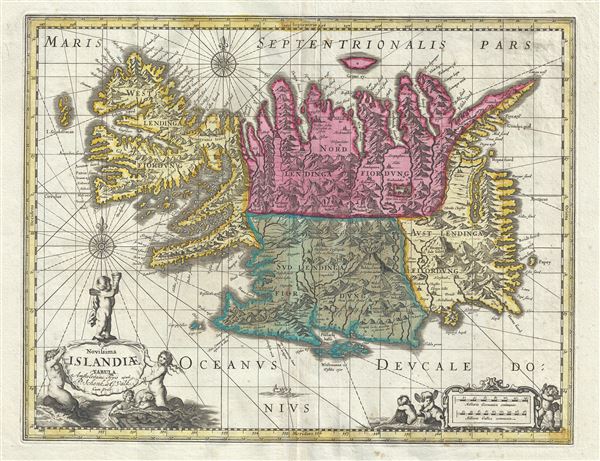
Novissima Islandiae Tabula.
1680 (undated) 16 x 20 in (40.64 x 50.8 cm) 1 : 1610000
1680 (undated) 16 x 20 in (40.64 x 50.8 cm) 1 : 1610000
Description
This is a beautiful c.1680 map of Iceland by Gerard Valk and Pieter Schenk. It covers the entire north Atlantic Island of Iceland and notes the four primary provinces in color. Iceland had been fairly well mapped since the late 16th century. This map notes several important rivers, mountain ranges and other topographical features. Lovers of Icelandic sagas will recognize many of the towns and cities noted.
An illustration of a fish is featured in the bottom of the map proper, with two beautiful compass roses and several rhumb lines. The title cartouche in the lower left quadrant and the lower right quadrant are beautifully illustrated with cherubs. This map was created by Gerard Valk and Pieter Schenk.
An illustration of a fish is featured in the bottom of the map proper, with two beautiful compass roses and several rhumb lines. The title cartouche in the lower left quadrant and the lower right quadrant are beautifully illustrated with cherubs. This map was created by Gerard Valk and Pieter Schenk.
Condition
Very good. Vivid colors. Original platemark visible. Minor wear along original centerfold with some verso reinforcements. Minor foxing at places.
References
OCLD Number: 494813638