This item has been sold, but you can get on the Waitlist to be notified if another example becomes available, or purchase a digital scan.
1759 Map of the Isle of Orleans and the Environs of Quebec City, Canada
IsleOrleans-gentlemans-1759$75.00

Title
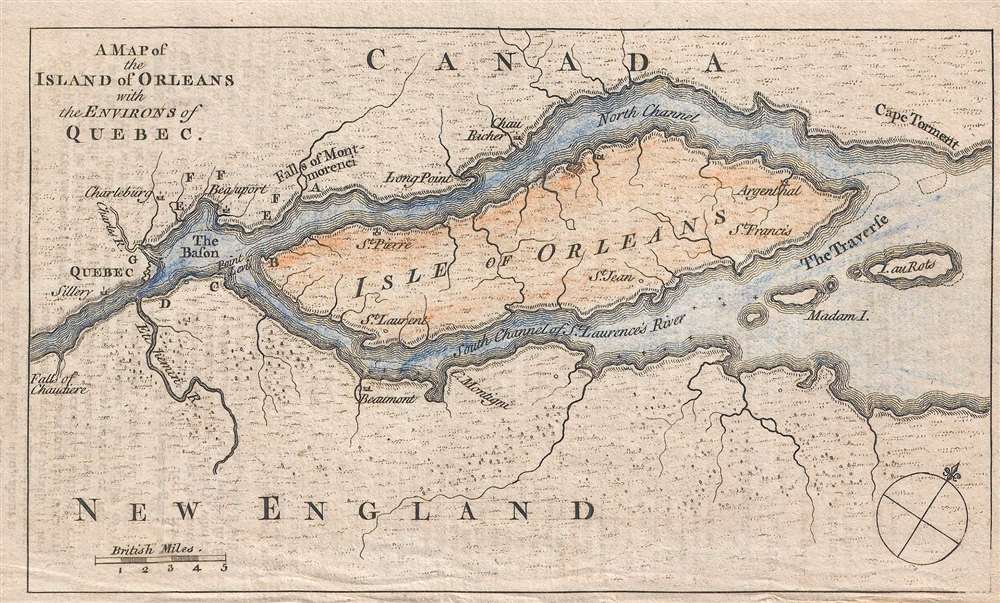
A Map of the Island of Orleans with the Environs of Quebec.
1759 (undated) 4.5 x 7.5 in (11.43 x 19.05 cm) 1 : 316800
1759 (undated) 4.5 x 7.5 in (11.43 x 19.05 cm) 1 : 316800
Description
This is a 1759 map of the Isle of Orleans (Isle d'Orléans) and the environs of Quebec City, Quebec, Canada. The map depicts the region from the Falls of Chaudiere (Chutes de la Chaudière) to Cape Torment and from the territory north of the North Channel of the St. Lawrence River to just south of the South Channel of the St. Lawrence River. Numerous locations throughout the region are labeled, including Charleburg, St. Laurent, St. Jean, Beaumont, and Argenthal. Madam Island and the Isle au Rots in the South Channel are also labeled. Montmorency Falls (Chutes Monmorency) are noted as Falls of Montmorenci, northeast of Quebec City.
This map was created and published in 1759.
This map was created and published in 1759.
Condition
Very good. Even overall toning. Light tranference from text. Blank on verso.