This item has been sold, but you can get on the Waitlist to be notified if another example becomes available, or purchase a digital scan.
1958 Salomone Pictorial Map of Italy
Italia-salomone-1958$100.00

Title
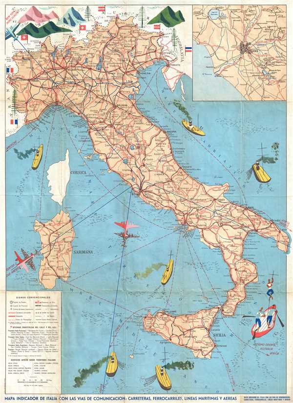
Mapa Indicador de Italia con las Vias de Comunicacion: Carreteras, Ferroarriles, Lineas Maritimas y Aereas.
1957 (undated) 31 x 22 in (78.74 x 55.88 cm) 1 : 1745000
1957 (undated) 31 x 22 in (78.74 x 55.88 cm) 1 : 1745000
Description
This is a c. 1957 Stab. L. Salomone map of Italy. The map depicts Italy from France, Switzerland, and Austria to Sicily and the Mediterranean Sea and from Corsica and Sardinia to the Adriatic Sea and Yugoslavia. The Italian road and rail network are illustrated in detail, with distances between cities noted along with smaller towns between the major cities, which are easily discernible. Genoa, Milan, Venice, Florence, Rome and Naples are all labeled in block lettering. International air routes are depicted by using blues lines, while shipping lanes are illustrated by red dashed lines. The flags of the bordering nations are included and employed to more easily identify those countries. An inset of Rome and its environs is situated in the upper right corner, while a legend sits in the lower left.
This map was published by Stab. L. Salomone c. 1957.
This map was published by Stab. L. Salomone c. 1957.
Condition
Very good. Verso repairs of fold separations. Repaired tear extending 1.5 inches into printed area from bottom margin. Text on verso. All text Italian.