This item has been sold, but you can get on the Waitlist to be notified if another example becomes available, or purchase a digital scan.
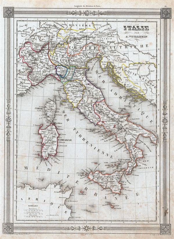
1852 Vuillemin Map of Italy
Italy-vuillemin-1852$50.00

Title
Italie.
1852 (undated) 13 x 10 in (33.02 x 25.4 cm)
1852 (undated) 13 x 10 in (33.02 x 25.4 cm)
Description
An uncommon and extremely attractive 1852 map of Italy by A. Vuillemin. Covers the pre-Garibaldi Italy split into numerous small duchies and states from Venetian Lombardy south to Sicily and Malta. Also includes the islands of Sardinia and Corsica. Throughout, the map identifies various cities, towns, rivers and assortment of additional topographical details. At this time in history, the peninsula was undergoing the Risorgimento, Italy's march toward national solidarity. Following the defeat of Napoleon and the merging of Sicily and Naples into the Two Sicilies, the Island of Sicily witnessed revolts against the Bourbon rule in 1820 and 1848. The final revolution in 1848 resulted in the island gaining independence from Bourbon control for 16 months. The map features a beautiful frame style border. Prepared by A. Vuillemin for publication as plate no. 16 in the 1852 edition Maison Basset of Atlas Illustre Destine a l'enseignement de la Geographie elementaire.
CartographerS
Alexandre Aimé Vuillemin (1812 - 1880) was an engraver, publisher, and editor based in Paris, France in the middle of the 19th century. Despite a prolific publishing career, much of Vuillemin's life is shrouded in mystery. In 1852, he married Josephine Caroline Goret and they had at least one child, Ernestine Adèle Vuillemin, later in the same year. What is known is that his studied under the prominent French Auguste Henri Dufour (1798 - 1865). Vuillemin's most important work his detailed, highly decorative large format Atlas Illustre de Geographie Commerciale et Industrielle. More by this mapmaker...
Jean Denis Barbie du Bocage (1760 - 1825) and his son Jean-Guillaume Barbie du Bocage (1795 - 1848) were French cartographers and cosmographers active in Paris during late 18th and early 19th centuries. The elder Barbie du Bocage, Jean Denis, was trained as a cartographer and engraver in the workshops of mapmaking legend J. B. B. d'Anville. At some point Jean Denis held the post of Royal Librarian of France and it was through is associations with d'Anville that the d'Anville collection of nearly 9000 maps was acquired by French Ministry of Foreign Affairs. The younger Barbie du Bocage, Jean-Guillaume, acquired a position shortly afterwards at the Ministry of Foreign Affairs and, in time, became its head, with the title of Geographe du Ministere des Affaires Etrangeres. Learn More...
Source
Barbie du Bocage, J. D., Atlas Illustre Destine a l'Enseignement de la Geographie Elementaire, (Paris: Maison Basset) 1852.
Condition
Very good. Blank on verso. Map exhibits some soiling and toning, especially to margins.