This item has been sold, but you can get on the Waitlist to be notified if another example becomes available.
1960 J. B. Prine Map of Jacksonville, Florida
JacksonvilleExpressways-prine-1960$200.00


Title
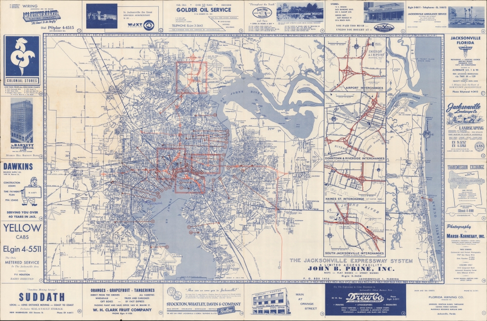
The Jacksonville Expressway System. A Limited Access Facility. John B. Prine, Inc.
1960 (dated) 25 x 38 in (63.5 x 96.52 cm) 1 : 53800
1960 (dated) 25 x 38 in (63.5 x 96.52 cm) 1 : 53800
Description
A large and impressive 1960 John B. Prine map of Jacksonville, Florida, detailing they city's expressway system.
A Closer Look
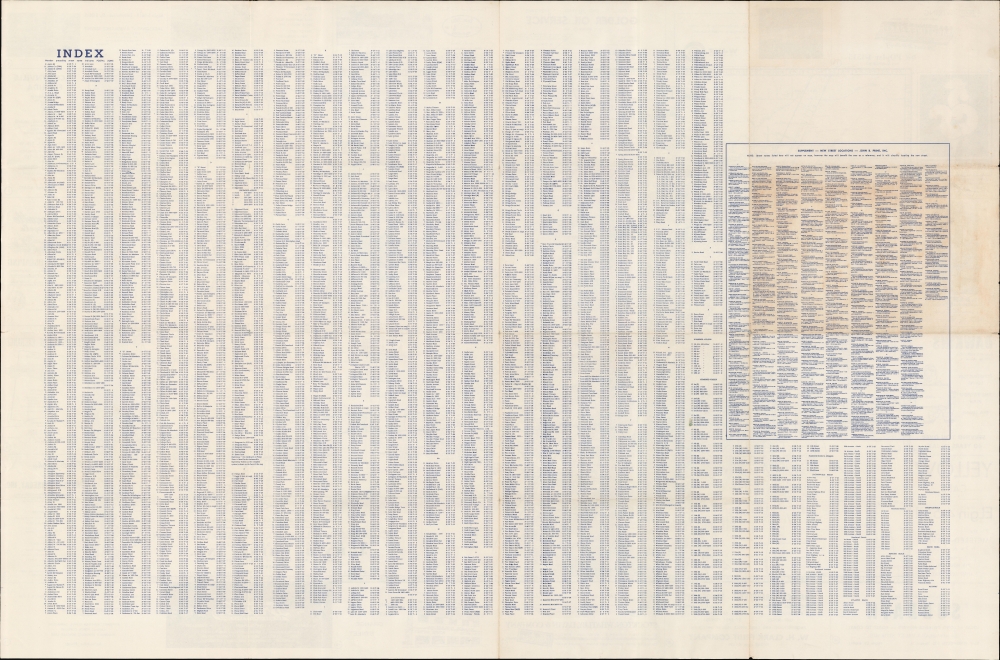
The map covers downtown Jacksonville centered around the St. John's River, and extending from Marietta in the west to the Jacksonville Beaches. The city's four major interchanges are highlighted and further detailed in submaps situated between the downtown core and the Atlantic. The map is surrounded by local advertising, ranging from department stores to gas stations, and, of note to map enthusiasts, 'H. and W. B. Drew Co.' At this time Drew was Jacksonville's 'oldest business firm' and, as lithographers, the printers of Florida's earliest natively published maps. The verso bears a detailed street index as well as a supplementary index addressing the wide-scale street renaming and development that occurred in the 1950s.Jacksonville Expressways
Between 1950 and 1967, the Jacksonville expressway system matured, reflecting the city's rapid growth and the nationwide expansion of urban road networks. This era marked the emergence of modern expressways designed to accommodate the American car craze. Major projects included the construction of key expressways like the Mathews Bridge, completed in 1953 (which facilitated traffic across the St. Johns River), and the Hart Bridge, opened in 1967 (which further enhanced river crossings). Interstate 95, a critical component of the national Interstate Highway System, also played a pivotal role in Jacksonville's network, providing a vital north-south artery through the city. These developments significantly improved connectivity, reduced travel times, and were integral to the city's economic growth and urban expansion.Publication History and Census
This map was compiled and published by John B. Prine in 1960. We do not see any examples in OCLC.Cartographer
John Burgsteiner Prine (September 1, 1907 - May 1968) was an American architect and landscape designer active in Jacksonville Florida in the mid 20th century. Prine was born in Thomasville, Georgia. He relocated to Jacksonville as a young man.Later, he lived in West Palm Beach, where he was employed with the Island Landscape Company. He died in Jacksonville. More by this mapmaker...
Condition
Very good. Slight wear along old fold lines. Pinhole loss at a few fold intersections.