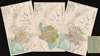
1961 Official Set of City Planning Maps (3) of Kaohsiung City, Taiwan
Kaohsiung-constructionbureau-1961$1,500.00


Title
Map of Existing Roads in Kaohsiung City. / Kaohsiung City Planning Map. / Geographical Map of Kaohsiung City Zones. / 高雄市都市既成道路圖 / 高雄市都市計畫圖 / 高雄市都市計書地域圖
1961 (dated) 29.25 x 18.5 in (74.295 x 46.99 cm) 1 : 20000
1961 (dated) 29.25 x 18.5 in (74.295 x 46.99 cm) 1 : 20000
Description
This is a rare collection of three 1961 or Minguo 50 official urban planning maps of Kaohsiung City (高雄市[I]), Takau, Taiwan. The maps are part of a city-wide urban development project intended to turn Kaohsiung into a major port. The plan was originally proposed in 1937 (Showa 12) under the Japanese, but was sidelined during World War II. The plans were revived by the KMT and put into development in the 1960s. Since that time, Kaohsiung has grown from a small trading village into the political and economic center of southern Taiwan. It is also Taiwan's largest and busiest harbor.
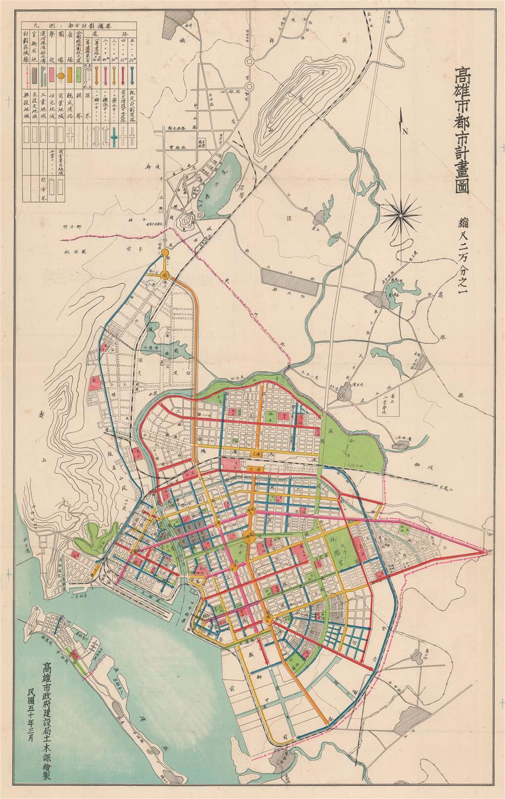
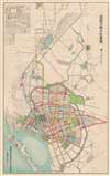
The second map, entitled Kaohsiung City Planning Map (高雄市都市計畫圖) offers a useful breakdown of major traffic patterns, as well as noting schools, public areas, parks, and more. Color coding illustrates the direction of traffic. A planned rail line is highlighted in pink.
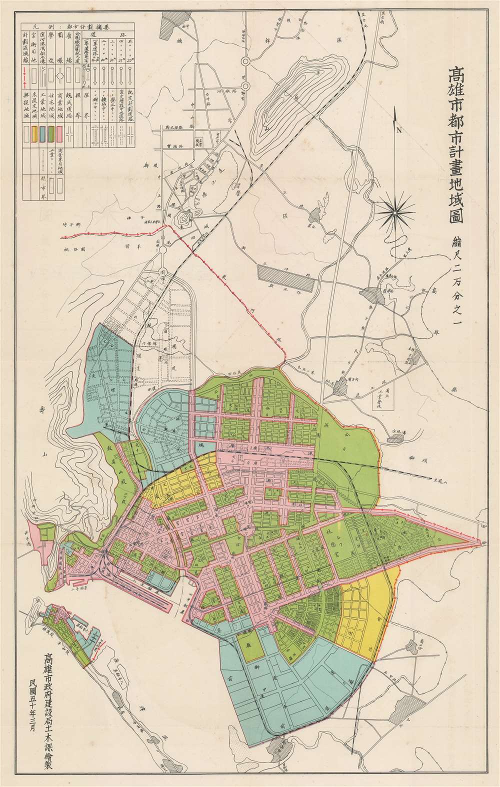
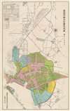
The third map Geographical Map of Kaohsiung City Zones (高雄市都市計書地域圖) employs brilliant color coding to illustrate city zoning. Pink represents commercial zones; green, residential; blue, industrial; and yellow, unallocated lands.
The Maps
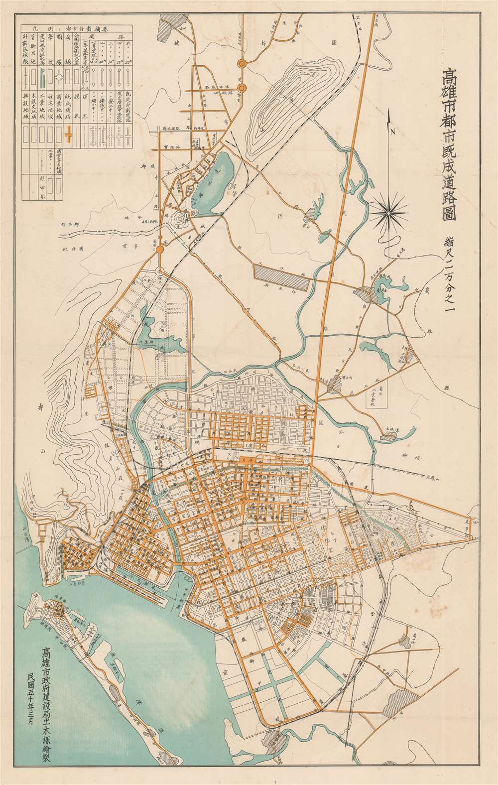
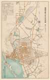
The first map is entitled Map of Existing Roads in Kaohsiung City (高雄市都市既成道路圖), depicts, as the title suggests, the city in its 1961 state, without any of the intended expansions and improvements. Major roadways are highlighted in yellow.The second map, entitled Kaohsiung City Planning Map (高雄市都市計畫圖) offers a useful breakdown of major traffic patterns, as well as noting schools, public areas, parks, and more. Color coding illustrates the direction of traffic. A planned rail line is highlighted in pink.
The third map Geographical Map of Kaohsiung City Zones (高雄市都市計書地域圖) employs brilliant color coding to illustrate city zoning. Pink represents commercial zones; green, residential; blue, industrial; and yellow, unallocated lands.
Chromolithography
Chromolithography is a color lithographic technique developed in the mid-19th century. The process involved using multiple lithographic stones, one for each color, to yield a rich composite effect. Oftentimes, the process would start with a black basecoat upon which subsequent colors were layered. Some chromolithographs used 30 or more separate lithographic stones to achieve the desired effect. Chromolithograph color could also be effectively blended for even more dramatic results. The process became extremely popular in the late 19th and early 20th centuries, when it emerged as the dominate method of color printing. The vivid color chromolithography produced made it exceptionally effective for advertising and propaganda imagery.Publication History and Census
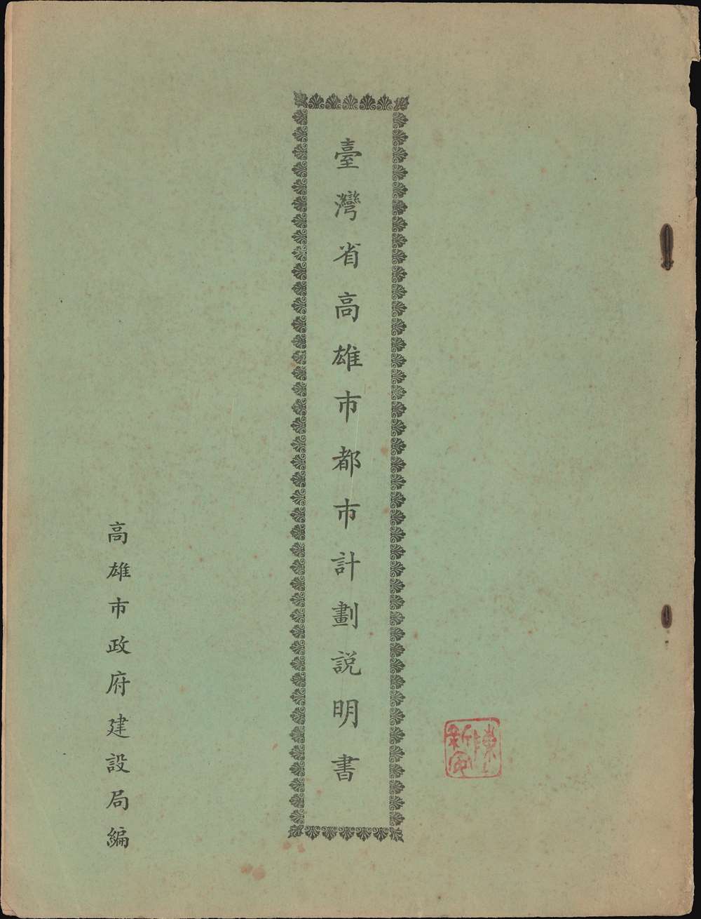
The maps are accompanied by a booklet, Kaohsiung City Planning Manual, Taiwan Province (臺灣省高雄市都市計劃說明書). It was issued by the Construction Bureau of the Kaohsiung City Government. We are aware of no other surviving examples in institutional collections, but some likely exist in Taiwan collections that are not part of the OCLC.Source
Kaohsiung City Planning Manual, Taiwan Province (臺灣省高雄市都市計劃說明書), (Taiwan) 1961.
Condition
Very good. Some wear on old fold lines.