This item has been sold, but you can get on the Waitlist to be notified if another example becomes available.
1957 Newman, Stern, and Mandell Map of Key Colony, Florida Keys
KeyColony-newmanstern-1957$62.50


Title
Florida Keys Map and Guide. Vacationland of Presidents.
1957 (undated) 22 x 16 in (55.88 x 40.64 cm)
1957 (undated) 22 x 16 in (55.88 x 40.64 cm)
Description
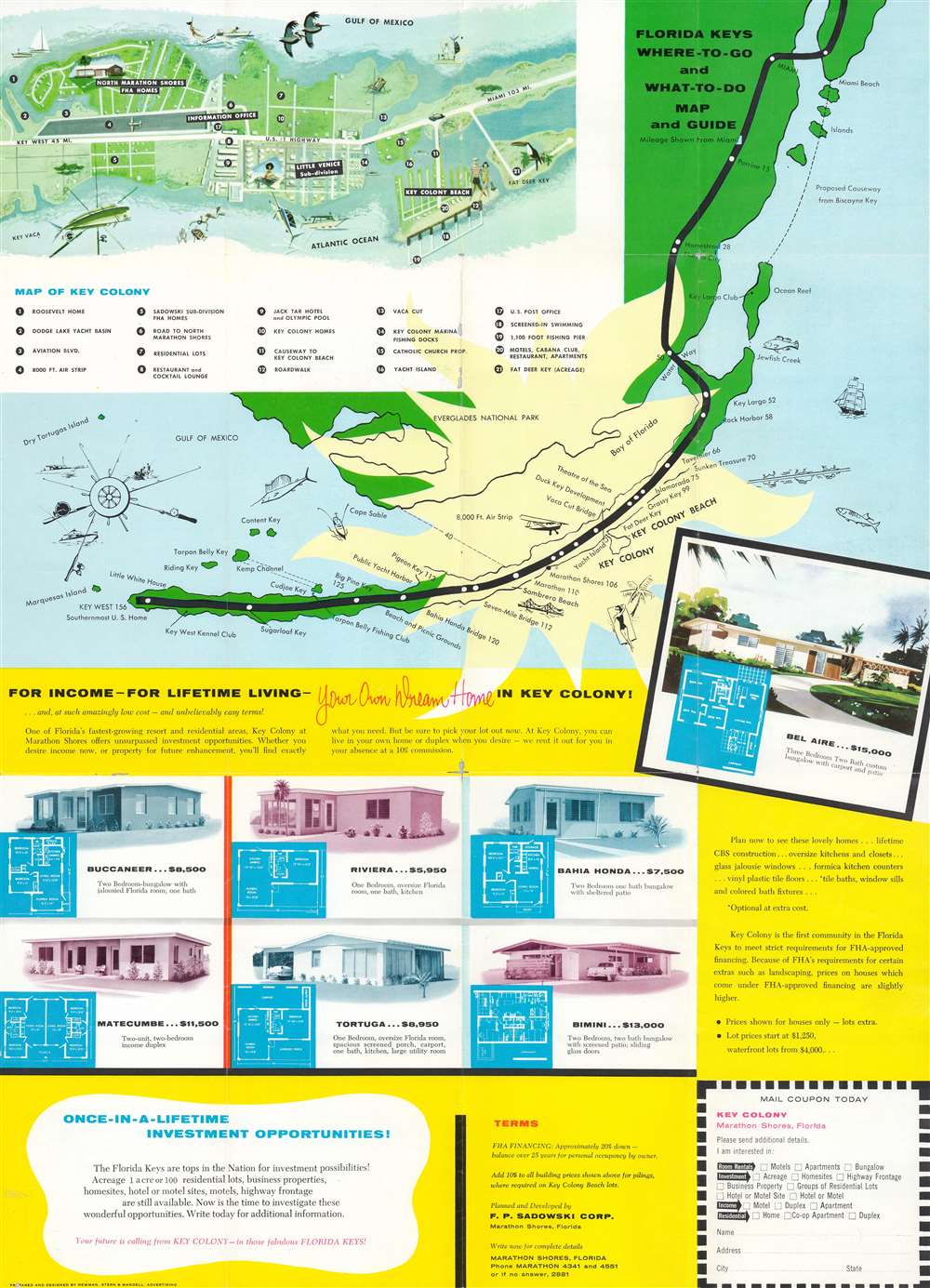
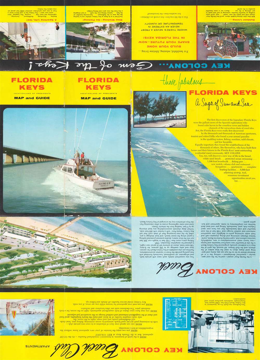
This is a c. 1957 Newman, Stern, and Mandell pictorial tourist map of Key Colony and the Florida Keys. A map of the Florida Keys from Miami to Key West occupies the upper portion of the sheet with individual keys and cities on peninsular Florida labeled. An inset in the upper left corner illustrates Key Colony and Key Colony Beach. Twenty-one locations within the inset are numerically identified and correspond with an index below the map, including restaurants, residential real estate lots, the Key Colony marina, and Fat Deer Key. The lower half of the sheet bears advertising for housing and other real estate investment opportunities in Key Colony Beach, a 'once-in-a-lifetime investment'. Generic illustrations of different houses and their floorplans are provided. Printed photographs and further persuasive text appears on the verso.
Newman, Stern, and Mandell
Newman, Stern, and Mandell, Inc. was an advertising firm in Miami Beach, Florida, founded in February 1955 by Leslie A. Stern, Stuart G. Newman, and Irving Mandell. The firm was reorganized in 1958 and was renamed Stern, Newman, and Hays, Inc. with Leslie A. Stern continuing as president of the firm, Stuart G. Newman continuing as secretary-treasurer, and O. W. Hays joining the firm as a vice president of the agency. Hays served as Art Director of the firm from September 1956 until the reorganization in 1958. Irving Mandell became the public relations representative for the Fontainebleau hotel.Publication History and Census
This map was prepared and designed by Newman, Stern, and Mandell c. 1957. This is the only known cataloged example.Condition
Average. Wear and small areas of loss along fold lines. Small areas of loss at some fold intersections. Promotional text and printed images on verso.