This item has been sold, but you can get on the Waitlist to be notified if another example becomes available.
1968 Vietnamese Manuscript Map of Kien Phong Province, South Vietnam
KienPhongManuscript-vietnamese-1968$500.00

Title
Phóng. Đồ. Vùng Đông Dân Cư.
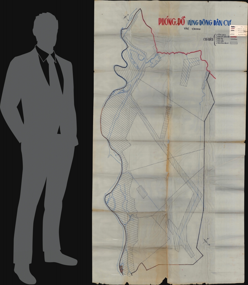
1968 (undated) 77.5 x 42.75 in (196.85 x 108.585 cm) 1 : 50000
1968 (undated) 77.5 x 42.75 in (196.85 x 108.585 cm) 1 : 50000
Description
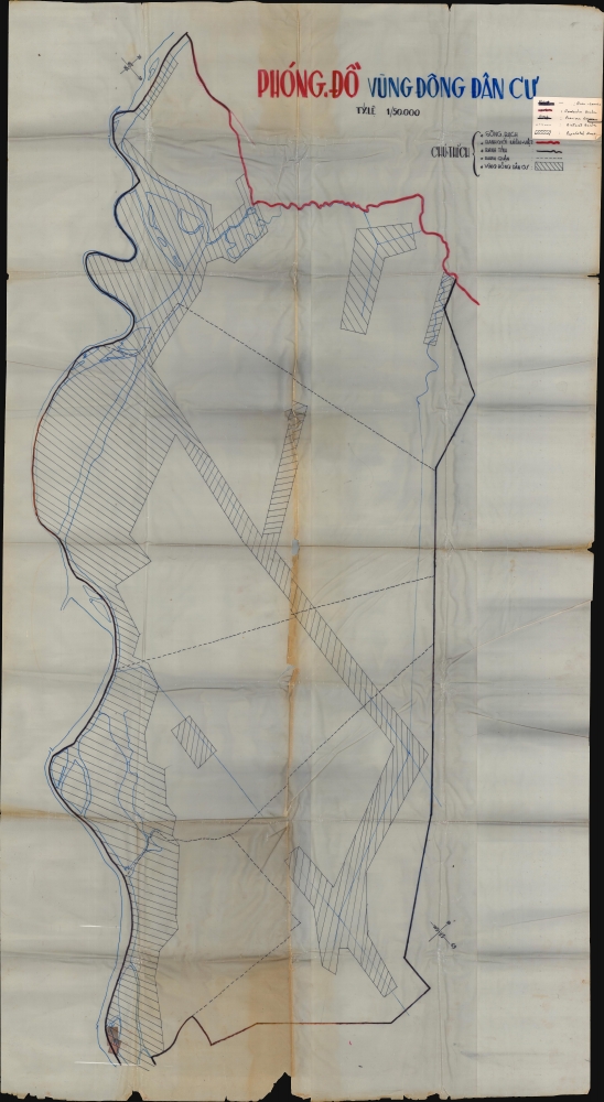
This is a large over 6-foot-tall c. 1968 Vietnamese manuscript map of Kien Phong Province, South Vietnam drawn on wax paper. Emphasizing the province's inhabited areas, the map likely played a role in planning operations during the Vietnam War.
A Closer Look
Depicting the entirety of Kien Phong Province, the red line at top indicates the Cambodian border. Dark black lines mark the province's borders, while blue lines highlight the Mekong River along the Province's western border and canals running through the province. Dashed lines indicate district borders and areas filled with diagonal lines mark the province's populated areas.Identifying Kien Phong Province
When comparing the present map with a 1968 map of South Vietnam provinces, Kien Phong Province matches geographically with the present map. The Cambodian border region looks nearly identical, and the district borders are an almost exact match. The presence of the (unlabeled) Mekong River along the western border provides further proof.Dating
We have assigned a c. 1968 date because it was part of the archive of Major General Ira A. Hunt Jr., who served in Vietnam as Chief of Staff of the 9th Infantry Division and as Commanding Officer of its 1st Brigade from May 1968 until June 1969.The Vietnam War
The Vietnam War, known in Vietnam as the Resistance War Against America or simply the American War, raged between November 1, 1955, and April 30, 1975, when Saigon fell to the North Vietnamese. A complicated conflict with an even more complicated history and legacy, the Vietnam War pitted the North Vietnamese, led by Ho Chi Minh, against the South Vietnamese. The South Vietnamese were supported by the United States, while the Soviet Union and China supported the North Vietnamese. American anti-communist dogma and fear that 'if one country fell to Communism, then more would fall' drove participation in the far-off civil war. As the conflict grew, American involvement became increasingly overt. Finally, in 1964, American ground troops were sent into combat. In 1968, U.S. troop strength in Vietnam reached its maximum at 549,500 soldiers. The same year saw the Tet Offensive, the most successful North Vietnamese campaign against American forces, and a waning of American home front support. U.S. forces withdrew in January 1973, and Saigon fell to the North Vietnamese on April 30, 1975.Provenance: Major General Ira A. Hunt
This map is from the archive of Major General Ira Augustus Hunt Jr. (1924 - 2022), an American Army officer, historian, and author. Born in Lincoln, Nebraska, Hunt entered the United States Military Academy at West Point, graduating in 1945, at which point he became a second lieutenant in the Corps of Engineers. He was sent overseas, where he served in several post-war engineer assignments in Europe. A distinguished military and academic career followed, including multiple prestigious degrees, as well as service in Korea. Pertinent to the current map, during the Vietnam War (1955 - 1975), he served as Chief of Staff of the 9th Infantry Division and as Commanding Officer of its 1st Brigade. After Vietnam, he was made Assistant Commandant of the Engineer School at Fort Belvoir, then Deputy Chief of Staff for Training and Schools at Headquarters TRADOC, Fort Monroe, Virginia. He retired in 1978, after which he wrote three books: The 9th Infantry Division in Vietnam: Unparalleled and Unequaled, Losing Vietnam: How America Abandoned Southeast Asia, and My Lai Cover-Up: Deceit and Incompetence.Condition
Poor. Manuscript map drawn on wax paper. Wear along original fold lines. Splits along fold lines with loss at some fold intersections. Separations at several fold intersections. All damage unrepaired since map is on wax paper.