1757 Bellin Map of French Guiana and Suriname
LaGuyane-bellin-1757$175.00

Title
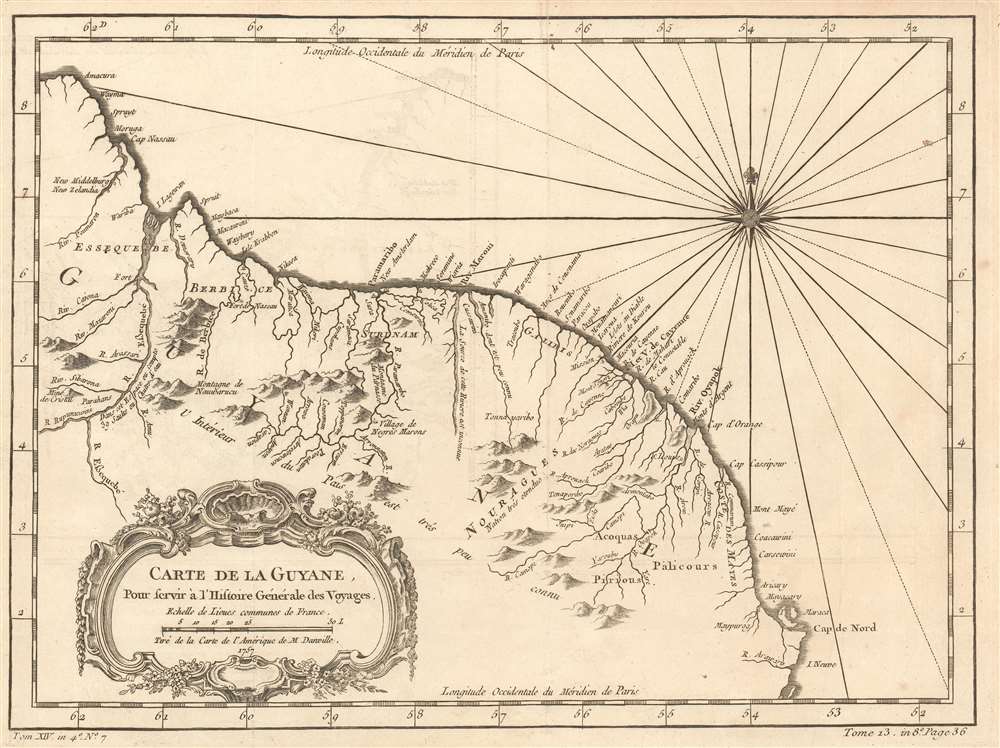
Carte de la Guyane. Pour servir á l'Histoire General des Voyages.
1757 (dated) 9 x 12.5 in (22.86 x 31.75 cm) 1 : 4000000
1757 (dated) 9 x 12.5 in (22.86 x 31.75 cm) 1 : 4000000
Description
This is a 1757 Jacques-Nicolas Bellin map of northeastern South America. The map depicts the region from the Essequibo River in Guyana through Suriname and French Guiana to the Araguari River in Brazil. Myriad locations are labeled along the Atlantic coast, including Paramaribo, Suriname. The vast majority of these locations are rivers, while others are towns along the coast. Some native villages are also identified, but the nations of the native peoples are at least referenced. Notes about the region are also included, stating, for example, that 'the interior of this country is not well known', or that 'the source of this river is unknown'. A note next to the Essequibo River states that 'in this region there are 39 waterfalls'.
Census and Publication History
This map was created by Jacques-Nicolas Bellin for publication in in Abbé Prévost's Histoire Générale des Voyages.Cartographer
Jacques-Nicolas Bellin (1703 - March 21, 1772) was one of the most important cartographers of the 18th century. With a career spanning some 50 years, Bellin is best understood as geographe de cabinet and transitional mapmaker spanning the gap between 18th and early-19th century cartographic styles. His long career as Hydrographer and Ingénieur Hydrographe at the French Dépôt des cartes et plans de la Marine resulted in hundreds of high quality nautical charts of practically everywhere in the world. A true child of the Enlightenment Era, Bellin's work focuses on function and accuracy tending in the process to be less decorative than the earlier 17th and 18th century cartographic work. Unlike many of his contemporaries, Bellin was always careful to cite his references and his scholarly corpus consists of over 1400 articles on geography prepared for Diderot's Encyclopedie. Bellin, despite his extraordinary success, may not have enjoyed his work, which is described as "long, unpleasant, and hard." In addition to numerous maps and charts published during his lifetime, many of Bellin's maps were updated (or not) and published posthumously. He was succeeded as Ingénieur Hydrographe by his student, also a prolific and influential cartographer, Rigobert Bonne. More by this mapmaker...
Condition
Very good. Even overall toning. Light wear along original fold lines. Light transference. Blank on verso.
References
OCLC 431523008