This item has been sold, but you can get on the Waitlist to be notified if another example becomes available, or purchase a digital scan.
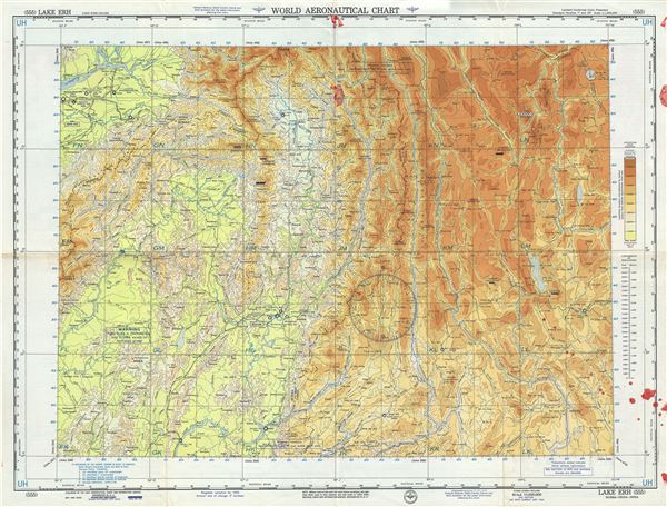
1956 U.S. Air Force Aeronautical Chart or Map of Burma (Myanmar), East India and Southern China
LakeErh-usaf-1956$50.00

Title
Lake Erh Burma-China-India.
1956 (dated) 22 x 29 in (55.88 x 73.66 cm) 1 : 1000000
1956 (dated) 22 x 29 in (55.88 x 73.66 cm) 1 : 1000000
Description
This is an unusual 1956 U.S. Air Force aeronautical chart or map of Lake Erh or Er or Erhai and its vicinity in modern day Yunnan Province of China. The map covers from Dibang in Northeast India east to Lugu Lake in northwest Yunnan and south to Bhamo in Burma or Myanmar. The map is highly detailed, noting warnings, important cities, towns, rivers, roads, railroads as well as other hydrographical and topographical features essential for the air pilot. The Brahmaputra and Irrawaddy Rivers are noted. Verso of this chart features legends and a world aeronautical chart index. This chart was published by the USAF Aeronautical Chart and Information Service, Washington 25, D.C., and was issued as chart no. 555. First issued in 1945, this is the tenth edition revised to September 1956.
Condition
Very good. Minor wear and toning along original fold lines. Red stains along lower right quadrant, top right centerfold and top left margin.