1955 U.S. Air Force Aeronautical Chart or Map of Lake Sap, Cambodia
LakeSap-usaf-1955$100.00

Title
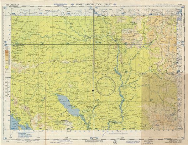
Lake Sap Cambodia-Laos-Thailand-Vietnam.
1955 (dated) 22 x 29 in (55.88 x 73.66 cm) 1 : 1000000
1955 (dated) 22 x 29 in (55.88 x 73.66 cm) 1 : 1000000
Description
This is a fine 1955 U.S. Air Force aeronautical chart of Lake Sap (Tonle Sap) and vicinity in Cambodia. It covers from the Gulf of Siam and Chanthaburi north to Chaiyaphum in Thailand and from Buon Ma Thuot north to Da Nang. Part of the Mekong River is also included. The map is highly detailed, noting important cities, towns, rivers, roads as well as other hydrographical and topographical features essential for the air pilot.
The Tonle Sap or Sap Lake, is the largest fresh water lake in Southeast Asia. This unusual combined lake and river system changes directions twice a year, when it drains into the Mekong River during the dry season and backs up during the rains to form the enormous Lake Sap.
Verso of this chart features legends and a world aeronautical chart index. This chart was published by the USAF Aeronautical Chart and Information Center, and was issued as chart no. 738. First issued in 1948, this is the seventh edition revised to March 1955.
Condition
Very good. Minor wear along original fold lines. Minor spotting. Toning along fold lines and lower right quadrant.