
1947 Smith Map of Lake Tahoe, California and Nevada

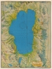
E. R. Smith Map of Lake Tahoe and Vicinity.
One of the better mid-century maps of Lake Tahoe.
$350.00
Choose a Collection:
- Digital Map Information
- Suitable for large format printing
- Full resolution TIFF file
- ICC color profile embedded
- Delivered instantly via download link
This Item
Enquire
One of the better mid-century maps of Lake Tahoe.
A very attractive 1947 Edward R. Smith map of Lake Tahoe.A Closer Look
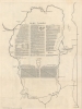
Coverage embraces all of Lake Tahoe as well as Fallen Leaf Lake to the south and the surrounding mountains. Unlike most commercially issued maps of Lake Tahoe, it includes depth soundings and navigation notes, making it useful for boaters and fishermen. On the verso there is a detailed discussion of the geological comportment and history of Tahoe.Publication History and Census
This map was issued by Edward R. Smith in consultation with A. C. Hammon and George Mathis. It was printed in 1947 by the Oakland-based Creative Lithograph company. Appears from time to time on the market, but originals are increasingly scarce. We note six examples in OCLC.Condition
Very good. A few archival verso mends.
References
OCLC 24551883. Rumsey 8391.000.