This item has been sold, but you can get on the Waitlist to be notified if another example becomes available, or purchase a digital scan.
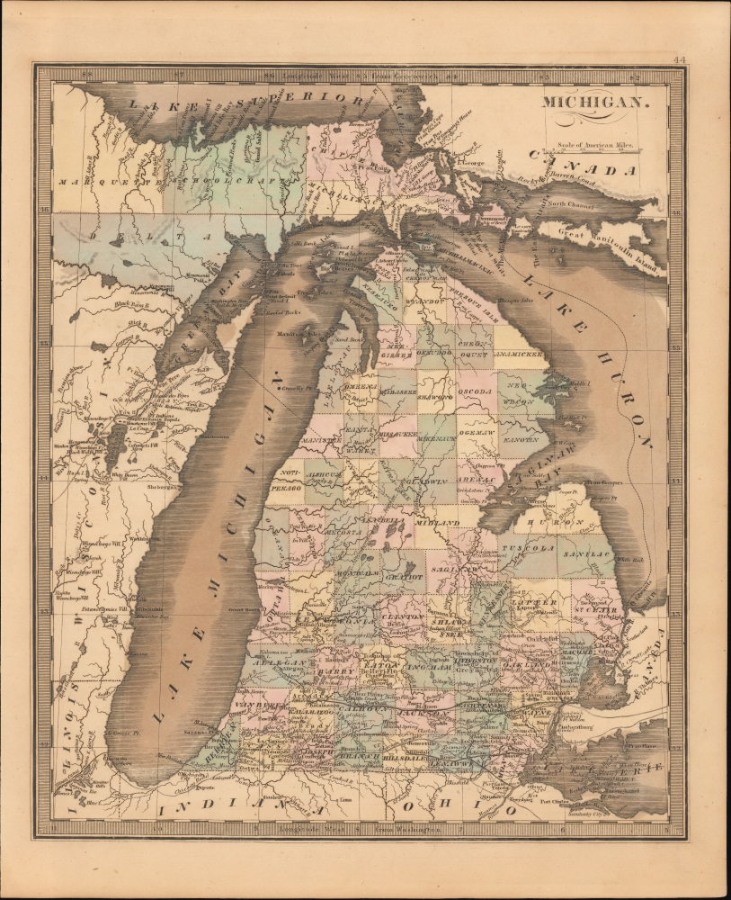
1849 Greenleaf Map of Michigan
Michigan-greenleaf-1849$175.00

Title
Michigan.
1849 (undated) 14 x 11 in (35.56 x 27.94 cm) 1 : 2050000
1849 (undated) 14 x 11 in (35.56 x 27.94 cm) 1 : 2050000
Description
This is Jeremiah Greenleaf's 1849 map of Michigan. This map represents a complete remapping of Michigan not seen in earlier Greenleaf or Burr atlases. The famously distended form of lake Michigan has here been partially modified to greater accuracy.
A Closer Look
Coverage embraces all of Michigan, as well as Lake Michigan, and adjacent parts of Lake Huron, Lake Erie, and Lake Superior. Michigan is broken into color coded counties. Roads and railroads are noted. Coverage extends west to include Chicago and the Illinois Canal, a vital artery for access to the Mississippi and lands west.Publication History and Census
This map is a much-updated revision of the David Hugh Burr map of 1833. The Burr map plates eventually fell into the hands of Jeremiah Greenleaf, who revised them for publication in his own Universal Atlas. The present example is from the 1849 edition of the atlas, the last and final, which nonetheless was extensively revised over the 1848. We note an example in the David Rumsey collection, which has been populated digitally throughout OCLC, making a comprehensive survey of existing physical examples nearly impossible. Nonetheless, the 1849 edition of the atlas is rare, with Rumsey correctly noted that it is not in Karpinski, despite being a new mapping of Michigan. We do note an example, however, in Phillips.Cartographer
Jeremiah Greenleaf (1791 - 1864) is a little known but highly admired American cartographer of the early 19th century. He published from roughly 1830 to 1850. His most important work is A New Universal Atlas; Comprising of all the Principal Empires, Kingdoms, and States Throughout the World and Forming a distinct Atlas of the United States, published in several editions in the 1840s. Many of his maps are reformatted versions of his contemporary David Burr's much admired cartographic works. Greenleaf's maps are extremely rare and admired for their stunningly vivid pastel color washes. More by this mapmaker...
Source
Greenleaf, J., New Universal Atlas, (Brattleboro, Vermont: Greenleaf) 1842.
Condition
Very good. Even toning. Some color oxidized.
References
Rumsey 15176.000.