This item has been sold, but you can get on the Waitlist to be notified if another example becomes available, or purchase a digital scan.
1914 London General Omnibus Company Bus Map of London, England
LGOCoMAP-omnibus-1914$37.50

Title
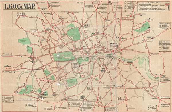
L. G. O. Co. Map.
1914 (undated) 12 x 18 in (30.48 x 45.72 cm) 1 : 62500
1914 (undated) 12 x 18 in (30.48 x 45.72 cm) 1 : 62500
Description
This is a nice 1914 World War I era transportation map of London issued by the London General Omnibus Company. Covers the city of London in beautiful detail with red lines showing motor us routes. The map also notes terminal points for weekends and weekdays as well as underground stations and connections. Streets, parks, docks, and bridges are also identified.
During World War I, many of London’s buses would be deployed to France and Belgium, leading to a huge reduction of bus service in the city. This map displays the bus routes around the time of the outbreak of the war. Issued by the London General Omnibus Company.
During World War I, many of London’s buses would be deployed to France and Belgium, leading to a huge reduction of bus service in the city. This map displays the bus routes around the time of the outbreak of the war. Issued by the London General Omnibus Company.
Condition
Good. Overall toning. Wear and some loss along original fold lines and fold intersections. Professionally flattened and backed with archival tissue.
References
Bibliotheque Nationale de France, departement Cartes et plans, GE D-9552.