This item has been sold, but you can get on the Waitlist to be notified if another example becomes available, or purchase a digital scan.
1863 Laurie / Findlay Map of England w/Lighthouses and Lightships
LighthousesEngland-laurie-1863$3,750.00

Title
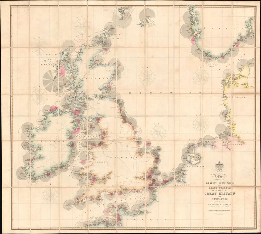
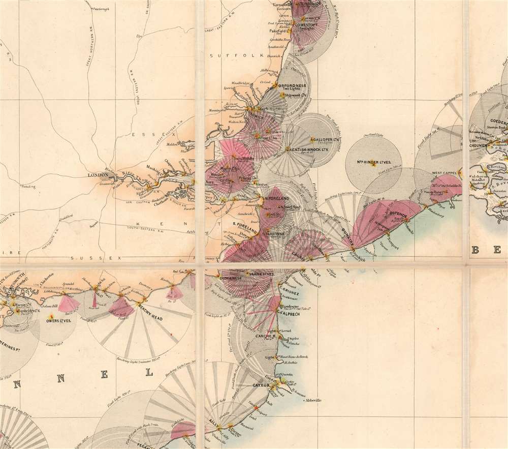
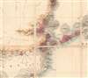
A Chart Exhibiting the Lighthouses and Light Vessels on the Coasts of Great Britain and Ireland and also those on the N.W. Coasts of Europe between Ushant and Bergen. Published by order of the Honble the Corporation of Trinity House, constructed by A. G Findlay.
1863 (dated) 53 x 59 in (134.62 x 149.86 cm) 1 : 2000000
1863 (dated) 53 x 59 in (134.62 x 149.86 cm) 1 : 2000000
Description
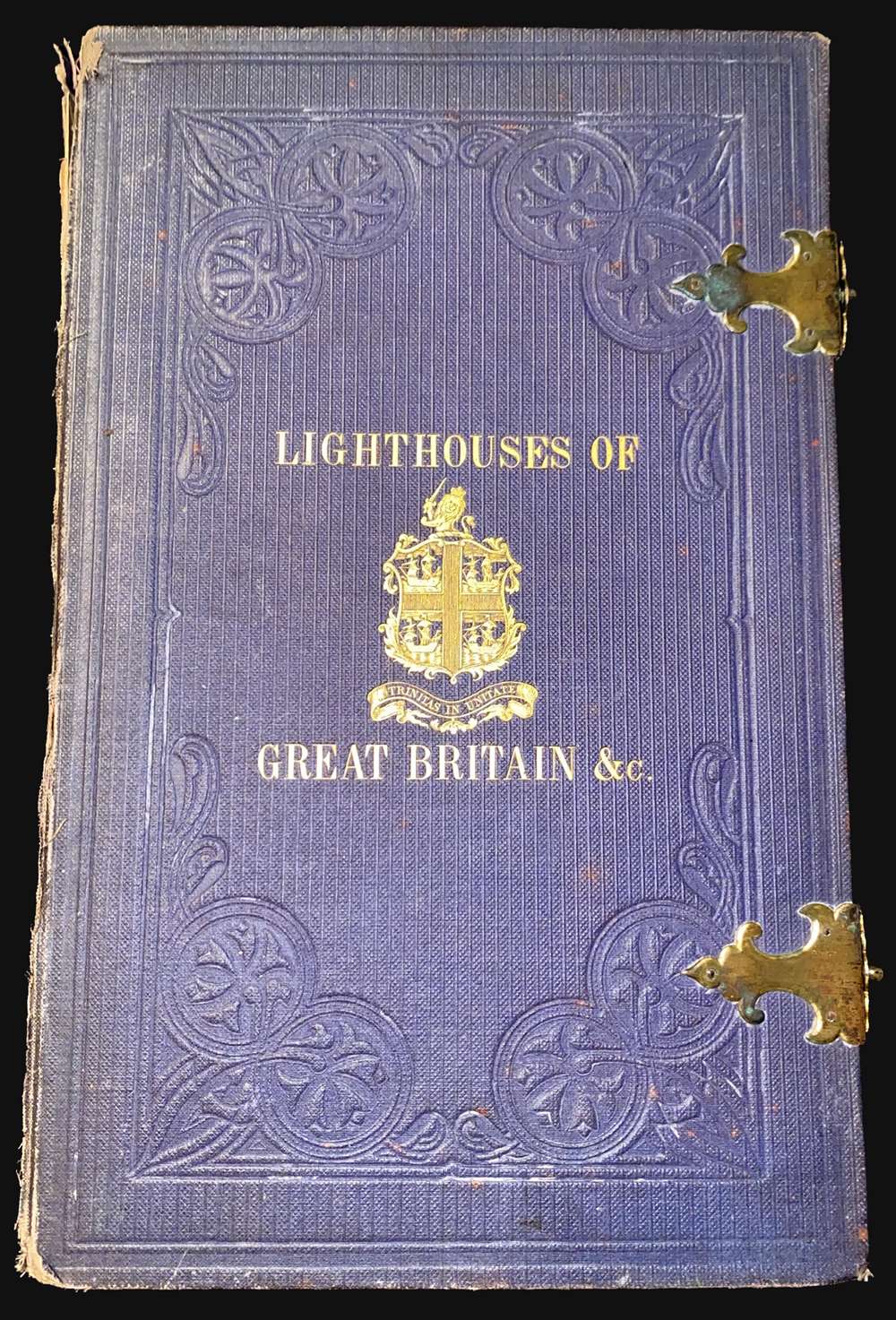
An extraordinary 1863 chart and map exhibiting in great detail the lighthouses of Great Britain, including England, Ireland, Wales, and Scotland, and around the North Sea as far as Norway, Holland, France, and Denmark. The chart provides essential information for the mariner with regard to understanding and identifying the region's many lighthouses and what they communicate. In addition, the map illustrates the major regional railroads and their connections to major ports. The whole is impressively presented in a handsome presentation case with gilt stamped cover and brass closures.
Reading the Chart
The chart employs a sophisticated coding system to explain and identify various lights. Most striking here are the red lights, which in general represent 'Red Tide Lights' - bright red lights that are activated when there is sufficient clearance at high tide. Some of these are fixed lights - represented by solidly shaded rings. Others are rotating lights with regular pulses, here identified by alternating light and dark shading. In some cases, there are double lights, signified by two red dots, or lights that shine in a pulse within a fixed partial circumference.Barra Head Lighthouse
One cannot help but notice the enormous visibility zone of the Barra Head Light, located at the southern top of the Hebrides, at the entrance to The Minch. The 58-foot (18-meter) stone tower, built in 1833, stands on the west side of Berra Head Island, on a high promontory, making the light the highest in the United Kingdom. It features a focal plane of 208 m (682 ft) above sea level and a range of 18 nautical miles (21 mi; 33 km).Trinity House
This map was published on behalf of Trinity House, whose armorial crest, four ships in a cross formation, appears above the title. The Corporation of Trinity House, formally 'The Master Wardens and Assistants of the Guild Fraternity or Brotherhood of the most glorious and undivided Trinity and of St Clement in the Parish of Deptford Strond in the County of Kent', was created in 1514 by a Royal Charter of King Henry VIII. It is the official authority for lighthouses in England, Wales, the Channel Islands and Gibraltar. Trinity House is responsible for the provision and maintenance of lighthouses and other navigational aids, such as light-vessels, buoys, and maritime radio/satellite communication systems. It is also an official deep-sea pilotage authority, providing expert navigators for ships trading in Northern European waters.Publication History and Census
This map was designed and engraved by Alexander George Findlay, and published by Richard Holmes Laurie on behalf of the Trinity House Corporation. Variations of this chart were published as early as 1833 - although in fact they were completely different maps, on a different scale, and engraved to different standards. The map is exceedingly scarce. The OCLC identifies three examples, those being held at the National Library of Scotland, the British Library at St. Pancras, and the University of Oxford. We are aware of a fourth example at the Royal Maritime Museum, Greenwich.CartographerS
Richard Holmes Laurie (December 2, 1777 - January 19, 1858) was a British map and chart publisher and seller. Born in London to publisher Robert Laurie and his wife Esther Jouret, R. H. Laurie took over his father's share of the Laurie and Whittle publishing firm upon his father's retirement in 1812 and began trading as Whittle and Laurie. After Whittle died in 1818, Laurie continued the business by himself, trading under the imprint R. H. Laurie. During the 1820s and 1830s, Laurie expanded the nautical chart business until he was overtaken by Admiralty charts. Laurie married Susan Ann Coates on February 6, 1814 and later married Mary Ann Dennison on October 15, 1833. He left his business and all his property in trust for his two surviving daughters (both of whom were minors) with his principal engraver, Alexander George Findlay. Findlay continued the business in Laurie's name after acquiring its equity from his daughters. More by this mapmaker...
Alexander George Findlay (January 6, 1812 - May 3, 1875) was an English geographer and hydrographer active in London during the middle part of the 19th century. Findlay was born in London to the Findlays of Arbroath, Forfarshire, a family long associated with nautical trades. Findlay's father, Alexander Findlay (apprentice to John Russell) was one of the original fellows of the Royal Geographical Society. The son, Alexander George Findlay, devoted himself to the compilation of geographical and hydrographical works, publishing various nautical works as well as historical atlases. In 1844 he was elected a fellow of the Royal Geographical Society. Most of Findlay's early nautical work was completed in association with the London geographical and print publishing firm of Laurie and Whittle. Following the 1858 death of Richard Holmes Laurie, Findlay took over the business, republishing many updated versions of established charts well into the late 19th century. Learn More...
Condition
Very good. Folds into original presentation binder w/brass clasps.
References
Royal Maritime Museum, G298:9/3. OCLC 1113295592.