1925 Combs Folding City Plan of Los Angeles
LosAngeles-combs-1925$450.00


Title
Map of Los Angeles. / Map of Los Angeles and District.
1925 (undated) 26.5 x 21 in (67.31 x 53.34 cm) 1 : 41500
1925 (undated) 26.5 x 21 in (67.31 x 53.34 cm) 1 : 41500
Description
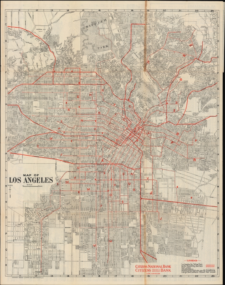
An impressively detailed c. 1925 Leslie Combs map of Los Angeles, produced for the Citizens National Bank and Citizens Trust and Savings Bank. It displays greater Los Angeles at a time of rapid growth, while highlighting the networks of the Los Angeles Railway streetcars and Pacific Electric Railway interurban trains.
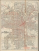
The verso includes three insets arranged in the box labeled 'Map of the Bay District': a main map including Brentwood (notable for noting a plot of land owned by Occidental College, a proposed but unrecognized plan for another campus, north of the Brentwood Country Club), Westwood, part of Beverley Hills, Santa Monica, Venice, and nearby neighborhoods; a small inset covering Pacific Palisades and Castellammare; and a small inset of Playa del Rey (near the site of the future Los Angeles International Airport). Below, another inset covers Wilmington and San Pedro, as well as the 'shoe-string' addition (also known as the Harbor Gateway) linking them to the main part of Los Angeles.
A Closer Look
Coverage on the recto includes much of the contemporary city of Los Angeles and nearby cities, with additional environs displayed on the verso. Large portions of the city, including most of the San Fernando Valley, are not presented, presumably because they were too undeveloped to merit inclusion. A grid surrounds the map, corresponding to a street index on the verso. The lines of the Los Angeles Railway (streetcars) and longer-distance Pacific Electric trains are highlighted in red, along with bus lines and locations of Citizens National Bank and Citizens Trust and Savings Bank. Land owned by the county and unincorporated communities stands out, including Universal City at the top-left. Universal City consists of studios and other properties belonging to Universal Studios that the City of Los Angeles never annexed. Streets, roads, parks, hotels, cemeteries, country clubs, reservoirs, hospitals, and other features are labeled throughout.The verso includes three insets arranged in the box labeled 'Map of the Bay District': a main map including Brentwood (notable for noting a plot of land owned by Occidental College, a proposed but unrecognized plan for another campus, north of the Brentwood Country Club), Westwood, part of Beverley Hills, Santa Monica, Venice, and nearby neighborhoods; a small inset covering Pacific Palisades and Castellammare; and a small inset of Playa del Rey (near the site of the future Los Angeles International Airport). Below, another inset covers Wilmington and San Pedro, as well as the 'shoe-string' addition (also known as the Harbor Gateway) linking them to the main part of Los Angeles.
Publication History and Census
This map was prepared by Leslie G. Combs for Citizens National Bank and Citizens Trust and Savings Bank. It is undated, but from the content (such as the location of the Ascot Speedway near Lincoln Park and the presence of the L.A. Memorial Coliseum but the lack of the Los Angeles Municipal Airport), it can be tentatively dated to the mid-1920s. OCLC notes two holdings: California State Library and Yale University.Cartographer
Leslie Gustav Combs (c. 1891 - 1976) was a draughtsman and cartographer based in Los Angeles, California. Born in Mexico City to an American father and Australian mother, he moved as a child to the United States. Nothing is known of his training and little of his career. A 1920 census lists him as a laborer, but the 1930 census notes him as a draughtsman working for the Los Angeles Fire Department. His cartographic output appears to have been minimal, and subsequent directories and census documents indicate that he took on a variety of professions during his life. More by this mapmaker...
Condition
Good. Toning evident on recto. Some wear and toning along original folds. Several small tears professionally repaired on verso. Folds into original covers.
References
OCLC 82498109.