This item has been sold, but you can get on the Waitlist to be notified if another example becomes available, or purchase a digital scan.
1910 Bisbal and Vassallo City Plan or Map of Madrid, Spain
Madrid-bisbalvassallo-1910$150.00

Title
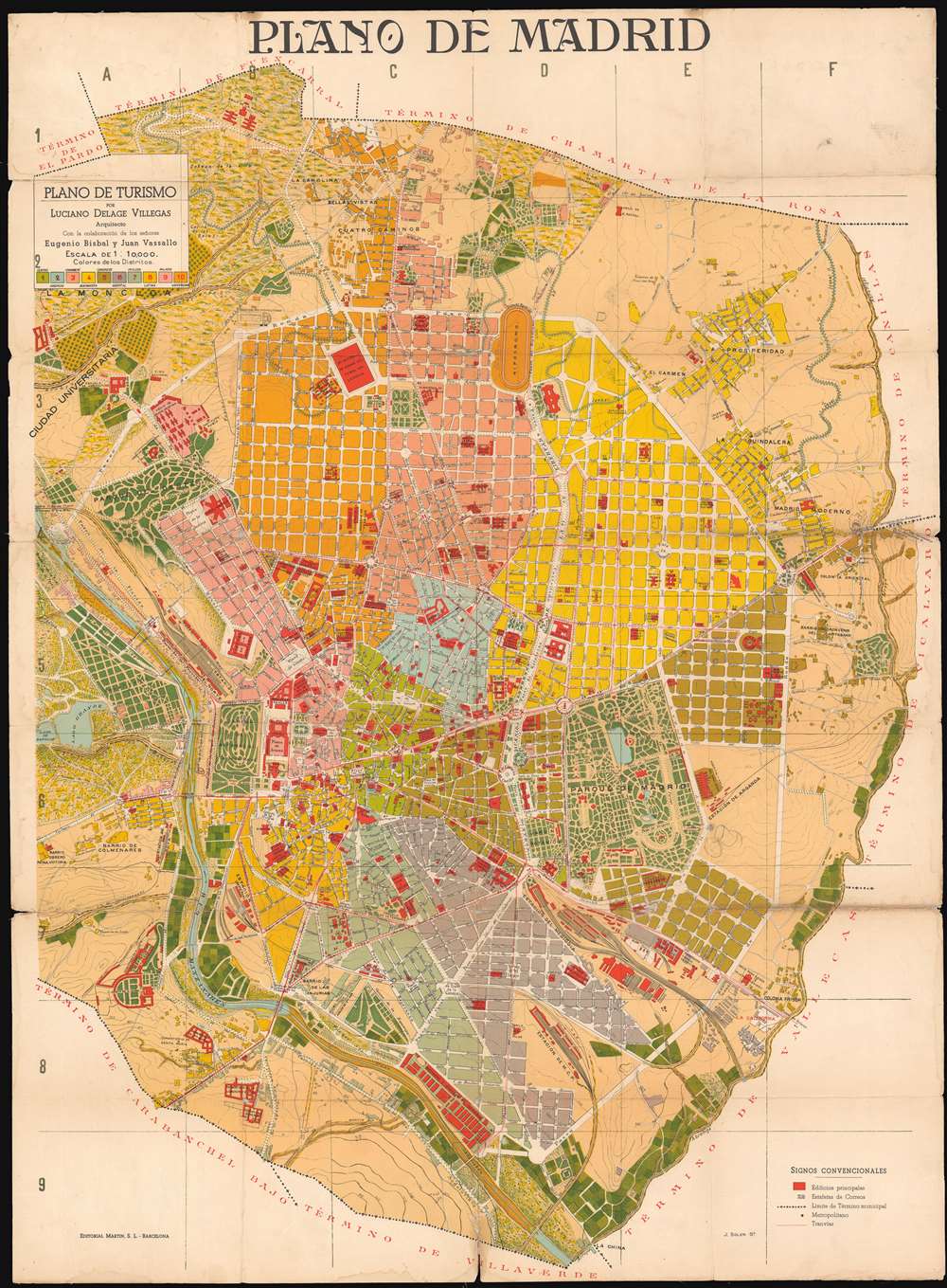
Plano de Madrid: Plano de Turismo.
1910 (undated) 37.5 x 27.5 in (95.25 x 69.85 cm) 1 : 10000
1910 (undated) 37.5 x 27.5 in (95.25 x 69.85 cm) 1 : 10000
Description
This is a 1910 Eugenio Bisbal and Juan Vassallo city plan or map of Madrid, Spain. The map depicts the city from the Lago de Patinar to the Colonia Oriental and from the Asilo de la Paloma to Termino de Villaverde. Highly detailed, the city is divided into ten districts, each of which is shaded a different color to allow for easy differentiation. Buildings throughout the city are illustrated and colored red, making them stand out against the rest of the color. Schools, hospitals, government buildings, churches, and train stations are all identified. Myriad streets are illustrated and labeled as well, as are the city's many parks and the Rio Manzanares.
Publication History and Census
This map was created by Eugenio Bisbal and Juan Vassallo and engraved by J. Soler for Luciano Delage Villegas, a Spanish architect based in Madrid. The OCLC records examples of this map as being part of the institutional collections at the University of Chicago and the Biblioteca Nacional de España.Condition
Good. Mounted on mesh backing. Light soiling. Exhibits areas of loss at fold intersections and along original fold lines. Blank on verso.
References
OCLC 667724459. Museo Municipal, Cartografia Madrileña (1635 - 1982) No. 80, (Madrid: Ayuntamiento de Madrid) 1982.