This item has been sold, but you can get on the Waitlist to be notified if another example becomes available, or purchase a digital scan.
1950 El Firmamento City Map or Plan of Madrid, Spain
Madrid-firmamento-1950$87.50

Title
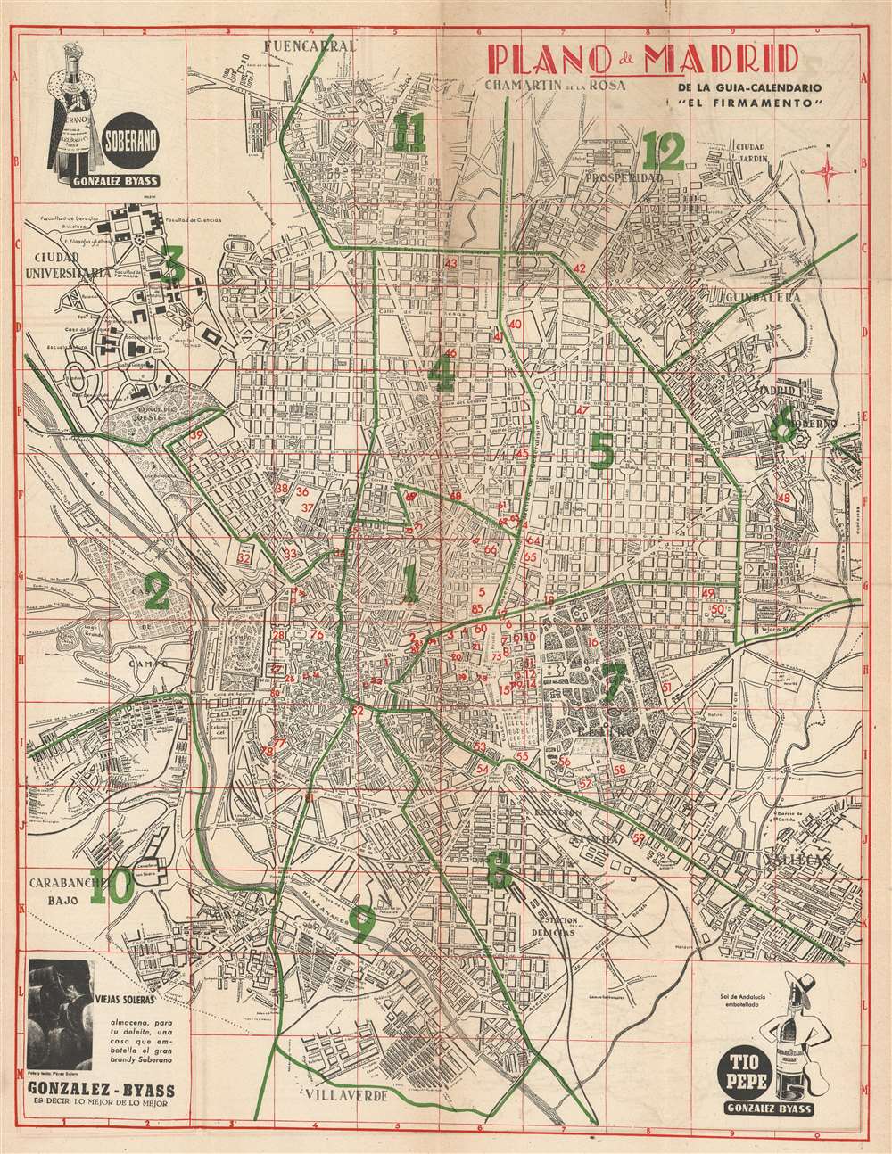
Plano de Madrid.
1950 (undated) 24.5 x 19 in (62.23 x 48.26 cm) 1 : 15300
1950 (undated) 24.5 x 19 in (62.23 x 48.26 cm) 1 : 15300
Description
This is a c. 1950 El Firmamento city map or plan of Madrid, Spain. The map depicts the city from the Casa de Campo and the Ciudad Universitaria to Vallecas and from Fuencarral to Villaverde. Different districts are labeled throughout the city, as are streets, plazas, and parks. The city parks are illustrated in detail, including the paths within the Parque del Oeste and the Parque del Retiro. Eighty-five public buildings and monuments are numerically identified and correspond with an index printed on the verso. Advertisements for the González Bayass sherry winery are printed in three of the map's four corners. A general advertisement for the winery is situated in the lower left corner, while the upper left corner advertises Soberano, the winery's most celebrated brandy, named in recognition of the winery's friendship with the King of Spain. An advertisement for Tio Pepe, a Fino stye sherry, is in the lower right corner.
Publication History
This map was created for and published in the guidebook 'El Firmamento' c. 1950. 'El Firmamento' is still published today.Condition
Good. Wear along original fold lines. Toning. Soiling. Map of central Madrid, the Necropolis, and the Iberian Peninsula on verso.