1956 U.S. Air Force Aeronautical Map of Mangabeiras Range, Tocantins, Brazil
MangabeirasRange-usaf-1956$100.00

Title
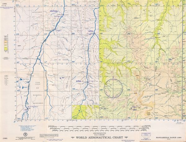
Mangabeiras Range Brazil.
1956 (dated) 22 x 29 in (55.88 x 73.66 cm) 1 : 1000000
1956 (dated) 22 x 29 in (55.88 x 73.66 cm) 1 : 1000000
Description
This is a fine 1956 U.S. Air Force aeronautical chart or map of the Mangabeiras Range, Brazil. It covers parts of the states of Tocantins, Bahia, Goias, Piaui, Maranhao, Para and Mato Grosso, extending from Sao Felix north to Conceicao Do Araguaia and east as far as Gilbuis. The map is highly detailed and notes several rivers, towns, lakes, villages and other hydrographical and topographical features essential for the air pilot. Verso of this chart features legends and a World aeronautical chart index. This chart was published by the USAF Aeronautical Chart and Information Center and was issued as chart no. 1068. First issued in 1954, this is the fourth edition revised to Nov 1956.
Condition
Very good. Minor wear and toning along original fold lines. Minor spotting.