1956 U.S. Air Force Aeronautical Map of the Eastern Coast of Alagoas, Brazil
ManguinhoPoint-usaf-1956$100.00

Title
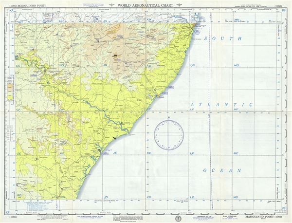
Manguinho Point Brazil.
1956 (dated) 22 x 29 in (55.88 x 73.66 cm) 1 : 1000000
1956 (dated) 22 x 29 in (55.88 x 73.66 cm) 1 : 1000000
Description
This is a fine 1956 U.S. Air Force aeronautical chart or map of the eastern coast of the state of Alagoas, Brazil. The chart, focusing on the Manguinho Point near the Penedo, covers the region from Esplanada north past Aracaju and Maceio to Recife and inland as far as Floresta. The map is highly detailed and notes several rivers, towns, lakes, villages and other hydrographical and topographical features essential for the air pilot. Verso of this chart features legends and a world aeronautical chart index. This chart was published by the USAF Aeronautical Chart and Information Center, and was issued as chart no. 1066. First issued in 1954, this is the fourth edition revised to Jan 1956.
Condition
Very good. Minor wear and toning along original fold lines. Minor spotting.