1956 U.S. Air Force Aeronautical Chart or Map of the Marajo Island, Brazil
MarajoIsland-usaf-1956$100.00

Title
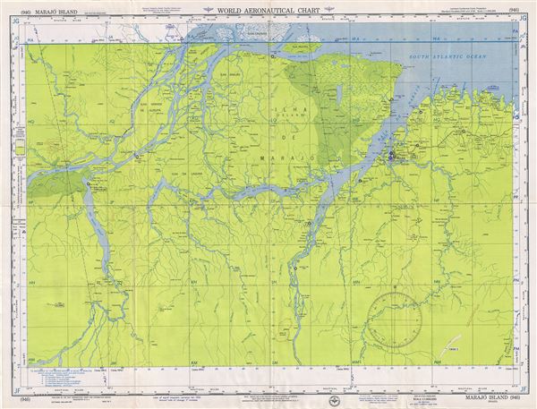
Marajo Island Brazil.
1956 (dated) 22 x 29 in (55.88 x 73.66 cm) 1 : 1000000
1956 (dated) 22 x 29 in (55.88 x 73.66 cm) 1 : 1000000
Description
This is a scarce 1956 U.S. Air Force aeronautical chart or map of the Marajo Island located on the mouth of the Amazon River in the State of Para, Brazil. It covers the region from the Rio Mucuru south to Maranha. Notes the cities of Belem, Macapa etc. The map is highly detailed and notes several rivers, marshes, towns, roads, bays, inlets and other hydrographical and topographical features essential for the air pilot. Verso of this chart features legends and a world aeronautical chart index. This chart was published by the USAF Aeronautical Chart and Information Service, and was issued as chart no. 946. First issued in 1950, this is the sixth edition revised to Mar 1956.
Condition
Very good. Minor wear and toning along original fold lines. Minor spotting.