1937 Qadri Marathi (Balbodh) Atlas of Hyderabad, India
MarathiAtlasHyderabad-qadri-1937$2,500.00


Title
हैदराबाद सचित्र ॲटलस / Pictorial Atlas of Hyderabad.
1937 (dated) 11 x 8.75 in (27.94 x 22.225 cm)
1937 (dated) 11 x 8.75 in (27.94 x 22.225 cm)
Description
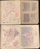
A remarkable find, this is an unrecorded 1937 educational atlas of Hyderabad, India, published in Balbodh, the Marathi script. Simultaneously published in Urdu and Telugu as well, the atlas reflects Hyderabadi pride, including the region's history and vibrant cultural mélange.
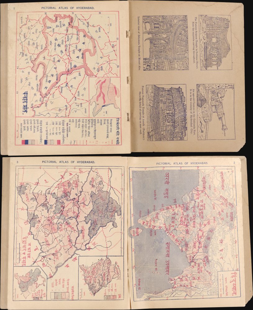
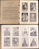
Map 2 covers the entire Raj (here as 'Hindustan' हिंदुस्थान). Map 3 covers Hyderabad and Varhad (हैद्राबाद व वऱ्हाड). Subsequent maps cover administrative districts centered on a large city, like Adilabad, Warangal, Karimnagar, Nanded, and Nizamabad. Following the maps are descriptive text on the history, environment, economy, and culture of Hyderabad and photographs of life in the Princely State, from wildlife (leopards), to temples, to local figures like farmers, sadhus (holy men), and an image of Qadri himself in a Western-style suit.
Photos of the royal family are also included, including the Nizam, Mir Osman Ali Khan, Asaf Jah VII (r. 1911 - 1948), who was featured on the cover of Time magazine in February 1937 and dubbed the richest man in the world (much of Hyderabad's wealth came from the Golconda diamond mines, long the world's only source of diamonds and the origin of many of the world's great diamonds, including the Hope Diamond and the controversial Koh-i-Noor).
Qadri also includes a preface discussing the atlas' production and laying out its parameters, as 'probably the first attempt of its kind to present the outstanding features of our country's geography and history in the three leading vernaculars - Marathi, Urdu, and Telugu.' It is notable that by 'our country,' Qadri is referring to Hyderabad rather than India.
Hyderabad sided with the British in subsequent wars against the Marathas and Mysore, and remained loyal to the British during the 1857 rebellion. The region also had a special trajectory during India's transition to independence and partition, being a mostly Hindu population ruled over by a Muslim dynasty. Hoping to maintain a degree of autonomy, the Princely State (which was also beset by a Communist insurgency) was effectively invaded and annexed by the Indian Army in September 1948, a move which was accompanied by mass communal violence between Hindus and Muslims that claimed thousands of lives.
A Closer Look
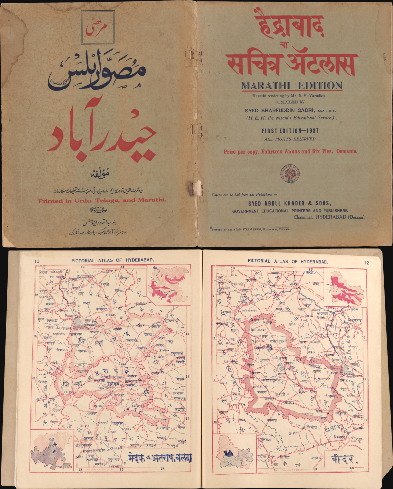
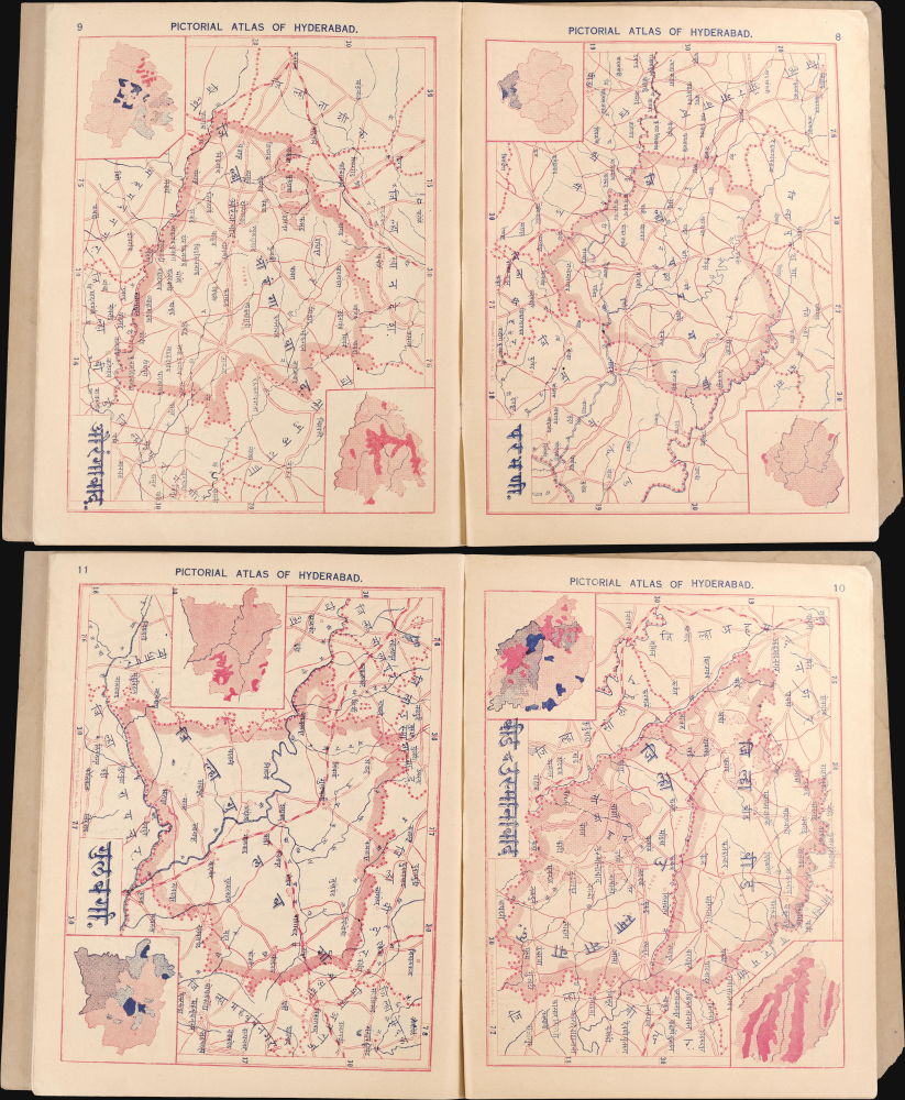
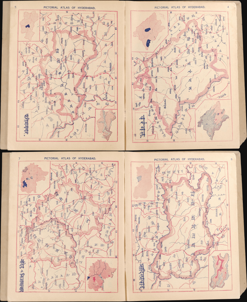
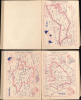
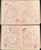
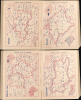
This remarkable atlas contains 16 single-page maps followed by photos and text. Map 1 covers Varhad (now Amravati), now part of Maharashtra, and includes a legend that applies to subsequent maps also, noting settlements and administrative centers of various sizes, schools, hospitals, post offices, railway lines and stations, and waterways. Most maps also include a topographical inset map noting elevation and a political inset map, using color-shading to denote the complex divisions between areas administered directly by the British, the Princely States, and special administrative areas like Baluchistan and the North West Frontier Province. The inclusion of Varhad (historically also known as Berar) is curious and perhaps reflective of a sort of irridentism, as it had been administered by the British despite nominally being ruled by the Nizam of Hyderabad, then in 1903 formally added to the neighboring British-administered Central Provinces.Map 2 covers the entire Raj (here as 'Hindustan' हिंदुस्थान). Map 3 covers Hyderabad and Varhad (हैद्राबाद व वऱ्हाड). Subsequent maps cover administrative districts centered on a large city, like Adilabad, Warangal, Karimnagar, Nanded, and Nizamabad. Following the maps are descriptive text on the history, environment, economy, and culture of Hyderabad and photographs of life in the Princely State, from wildlife (leopards), to temples, to local figures like farmers, sadhus (holy men), and an image of Qadri himself in a Western-style suit.
Photos of the royal family are also included, including the Nizam, Mir Osman Ali Khan, Asaf Jah VII (r. 1911 - 1948), who was featured on the cover of Time magazine in February 1937 and dubbed the richest man in the world (much of Hyderabad's wealth came from the Golconda diamond mines, long the world's only source of diamonds and the origin of many of the world's great diamonds, including the Hope Diamond and the controversial Koh-i-Noor).
Qadri also includes a preface discussing the atlas' production and laying out its parameters, as 'probably the first attempt of its kind to present the outstanding features of our country's geography and history in the three leading vernaculars - Marathi, Urdu, and Telugu.' It is notable that by 'our country,' Qadri is referring to Hyderabad rather than India.
Hyderabad between the Mughals and the Raj
Hyderabad, a Princely State of the British Raj, was nominally ruled by the Asaf Jahi Dynasty of Nizams. Located in the south-central part of the Subcontinent, the Princely State was much larger than today's municipality of Hyderabad, also including most of the present-day state of Telangana, as well as portions of Karnataka, Maharashtra, and Andhra Pradesh. It was always a special territory, with the Nizams initially serving as viceroys of the Mughals from 1713 but quickly becoming semi-independent. Hyderabad was a frontline in the battle between the Mughals and Marathas at the turn of the 18th century. Afterward, it became the earliest and wealthiest of the Princely States, aligning with the British after having failed to defeat them in an alliance with the Marathas and Mysore in the late 18th century.Hyderabad sided with the British in subsequent wars against the Marathas and Mysore, and remained loyal to the British during the 1857 rebellion. The region also had a special trajectory during India's transition to independence and partition, being a mostly Hindu population ruled over by a Muslim dynasty. Hoping to maintain a degree of autonomy, the Princely State (which was also beset by a Communist insurgency) was effectively invaded and annexed by the Indian Army in September 1948, a move which was accompanied by mass communal violence between Hindus and Muslims that claimed thousands of lives.
Publication History and Census
This atlas was prepared by Syed Sharfuddin Qadri, printed by the Azam Steam Press, and published in 1937 by Syed Abdul Khader and Sons, all in Hyderabad. We have been unable to locate information on these individuals and firms beyond what is presented here, but all appear to have been affiliated with the Nizam's government in one form or another, with Qadri being an official in the Nizam's Educational Service. We are unaware of any other examples of this work, including its Urdu and Telugu editions, in institutional collections or on the market.Condition
Good. Original covers separated. Some edge wear. 24 page of photos. 11 pages of text. 16 single page maps.