This item has been sold, but you can get on the Waitlist to be notified if another example becomes available.
1976 Consuelo Joerns Pictorial Map of Martha's Vineyard
MarthasVineyard-consuelojoerns-1976$275.00

Title
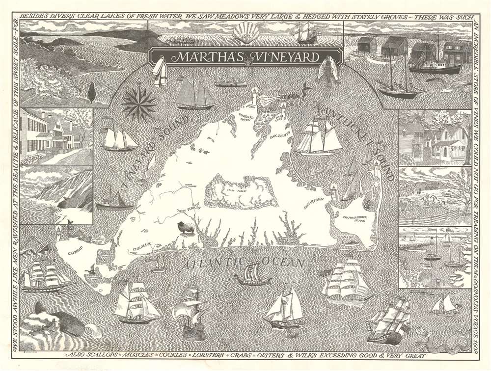
Martha's Vineyard.
1976 (undated) 24.25 x 32.25 in (61.595 x 81.915 cm) 1 : 60000
1976 (undated) 24.25 x 32.25 in (61.595 x 81.915 cm) 1 : 60000
Description
A stunning 1976 pictorial map of Martha's Vineyard. Lithographed in a striking black and white pen and ink style, the map covers all of Martha's Vineyard with vignette illustrations of the island's iconic homes, scenery, and ships. A wale appears in the lower left in reference to the island's whaling heritage. Edgartown, Vineyard Haven, Oak Bluffs, Chilmark and West Tisbury are all identified. The border of the map features quotes from Bartholomew Gosnold (1571 - 1607) who discovered Martha's Vineyard in 1602.
Publication History and Census
This map is undated, but we have identified a copyright entry in August of 1976. Lithograph. Surprisingly rare, with no other examples found.Cartographer
Consuelo Joerns (October 20, 1925 - present) is an illustrator, fine artist, and children's book author. Joerns lives in Wiscasset, Maine. She was a close lifelong friend of cartoonist Edward Gorey. We are aware of two pictorial maps attributed to Joerns, one of Martha's Vineyard and another of Cape Cod. More by this mapmaker...
Condition
Very good. Lithograph. Light water stain lower margins, left side.