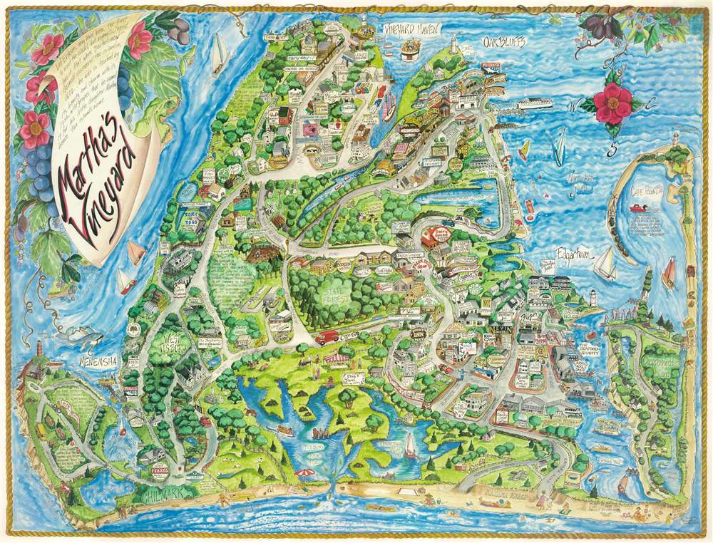
1986 Datz Pictorial Map of Martha's Vineyard, Massachusetts
MarthasVineyard-datz-1986$300.00


Title
Martha's Vineyard.
1986 (dated) 24 x 31.25 in (60.96 x 79.375 cm)
1986 (dated) 24 x 31.25 in (60.96 x 79.375 cm)
Description
This is a 1986 Margot Datz pictorial map of Martha's Vineyard, Massachusetts. Buildings are illustrated in profile and banners and signs advertise local businesses, including restaurants, hotels, and shops. Specific beaches are identified by name, including Stonewall Beach, South Beach, and Katama Beach. Streets are labeled, along with ponds, bays, harbors, and Nantucket Sound. A title cartouche appears at upper left and includes local folklore regarding the naming of Martha's Vineyard.
Publication History and Census
This map was drawn by Margot Datz and published by White Mountain Graphics in 1986.Condition
Very good. Mounted on linen.