1951 U.S. Air Force Aeronautical Map of Maug Islands, Mariana Islands, Pacific
MaugIslands-usaf-1951$100.00

Title
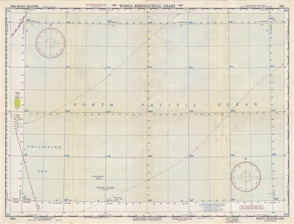
Maug Islands Mariana Islands.
1951 (dated) 22 x 29 in (55.88 x 73.66 cm) 1 : 1000000
1951 (dated) 22 x 29 in (55.88 x 73.66 cm) 1 : 1000000
Description
This is a scarce 1951 U.S. Air Force aeronautical chart or map of Maug Islands, a group of three small uninhabited islands which are part of the Mariana Islands in the Pacific Ocean. It covers Maug Islands and Farallon de Pajaros Island or Urracas Island in the northern Mariana Island chain. Verso of this chart features legends and a world aeronautical chart index. This chart was published by the USAF Aeronautical Chart and Information Service, and was issued as chart no. 609. First issued in 1942, this is the second edition revised to June 1951.
Condition
Very good. Minor wear and toning along original fold lines. Minor spotting.